Pricing Change
New pricing for orders of material from this site will come into place shortly. Charges for supply of digital images, digitisation on demand, prints and licensing will be altered.
Ardrishaig Harbour, South Breakwater, Lighthouse
Beacon (19th Century)
Site Name Ardrishaig Harbour, South Breakwater, Lighthouse
Classification Beacon (19th Century)
Alternative Name(s) Ardrishaig 1; Ardrishaig Breakwater, Lighthouse
Canmore ID 39403
Site Number NR88NE 33.01
NGR NR 85467 85309
Datum OSGB36 - NGR
Permalink http://canmore.org.uk/site/39403
- Council Argyll And Bute
- Parish South Knapdale
- Former Region Strathclyde
- Former District Argyll And Bute
- Former County Argyll
NR88NE 33.01 85467 85309
Location formerly cited as NR 8547 8531.
Lighthouse (flashing white, red, green) [NAT]
OS (GIS) AIB, May 2006.
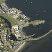
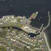
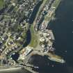
This feature is visible on the aerial photograph of Ardrishaig from SE. These modern navigational lights are situated at the end of the breakwater (NR88NE 33.02) flanking the canal entrance.
RCAHMS 1992.
(Ardrishaig 1: location cited as NR 855 853). At end of S breakwater: prob. c. 1880. Cylindrical concrete tower with bull-nosed band at top. Steel circular-section lantern with triangular panes of curved glass, low-pitched conical roof and ventilator with arrow vane. Cast-iron brackets above and below glazing on S side of lantern.
J R Hume 1997.
This feature is marked as a lighthouse on the 1st edition of the OS 6-inch map (Argyllshire 1873, sheet clxx), on the 2nd edition of the OS 6-inch map (Argyllshire 1900, sheet clxxNE), on the current edition of the OS 1:10000 map (1981) and on the OS 1:10000 raster map (ND).
Information from RCAHMS (MD) 12 July 2001.


