
High Keil


Dun (Period Unassigned)
Site Name High Keil
Classification Dun (Period Unassigned)
Alternative Name(s) Keil House Policies
Canmore ID 38307
Site Number NR60NE 9
NGR NR 6789 0802
Datum OSGB36 - NGR
Permalink http://canmore.org.uk/site/38307


- Council Argyll And Bute
- Parish Southend
- Former Region Strathclyde
- Former District Argyll And Bute
- Former County Argyll
NR60NE 9 6789 0802.
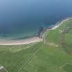
NR 679 080 On the tip of a small promontory overlooking Dunaverty Bay, 180m S of High Keil farmhouse and at a height of 30m OD, there are the slight remains of what was probably a circular dun measuring internally about 15m in diameter. On the N and E the wall is represented by a curved stony bank measuring 0.6m in height and 9m in thickness, but on the W and S erosion of the promontory has removed all traces of the wall except for a few large boulders.
RCAHMS 1971, visited 1961
NR 6789 0803 - The scant, turf-covered remains of a dun as described by RCAHMS.
Surveyed at 1:10 000.
Visited by OS (NKB) 23 October 1977

