Pricing Change
New pricing for orders of material from this site will come into place shortly. Charges for supply of digital images, digitisation on demand, prints and licensing will be altered.
Buddon Ness, Low Lighthouse
Lighthouse (19th Century)
Site Name Buddon Ness, Low Lighthouse
Classification Lighthouse (19th Century)
Alternative Name(s) Barry Buddon; Barry Links; Budden Ness; Lighthouse Bluff; Outer Tay Estuary; Firth Of Tay; North Sea
Canmore ID 113888
Site Number NO53SW 55
NGR NO 54211 30841
Datum OSGB36 - NGR
Permalink http://canmore.org.uk/site/113888
- Council Angus
- Parish Barry
- Former Region Tayside
- Former District Angus
- Former County Angus
NO53SW 55.00 54211 30841
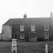
NO53SW 55.01 54190 30776 Keepers' Houses
See also:
NO53SW 21 53904 30986 Old High Lighthouse and Keeper's House
NO53SW 93 53883 31008 High Lighthouse
Buddon Ness
Low Lighthouse
(Disused) [NAT]
OS 1:10,000 map, 1974.
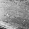
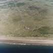
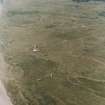
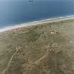
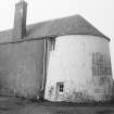
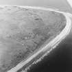
The two lighthouses on Buddon Ness were built in 1865-6 by engineers D and T Stevenson. The high lighthouse (NO53SW 21) is a tall circular tower and still in use; the low lighthouse (NO53SW 55) is a similar but shorter building, which is now disused.
J R Hume 1977.
Because the entrance channel (of the Tay) was altering with the slow movement of sandbanks, the lower (outer) tower on Buddon Ness was moved bodily 160 ft (48.7m) to the NE between 5th May and 4th June 1884 so as to form a pair of leading marks on the new alignment with the High Light (N53SW 21); the Keepers' Houses (NO53SW 55.01) were left in their original location.
R W Munro 1979.
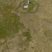
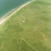
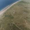
Buddon Ness Low Light (Stationary White) is presently situated 63m NE of the now unroofed lighthouse keepers cottages (NO 54190 30778). The original position of the lighthouse was at c.NO 54188 30788, adjacent to the cottages. In 1884, the lighthouse was moved to the present position.
The lighthouse is brick and stone built with traces of the whitewash son the brickwork till visible. The entrance is on the SE and the lamp is showing signs of deterioration. The lighthouse would appear to be out of use.
The cottages are now in a dangerous condition, unroofed with some walls collapsing and are fenced off to prevent public access.
Visited by RCAHMS (DE, SW), 10 August 2005
NO53SW 55.00 54211 30841
NO53SW 55.01 54190 30776 Keepers' Houses
NMRS REFERENCE
Architect: R. Stevenson, Engineer, 1865-66.
Construction (1865 - 1866)
The two lighthouses on Buddon Ness were built in 1865-6 by engineers D and T Stevenson. The high lighthouse (NO53SW 21) is a tall circular tower and still in use; the low lighthouse (NO53SW 55) is a similar but shorter building, which is now disused.
J R Hume 1977.
Modification (4 June 1884)
Because the entrance channel (of the Tay) was altering with the slow movement of sandbanks, the lower (outer) tower on Buddon Ness was moved bodily 160 ft (48.7m) to the NE between 5th May and 4th June 1884 so as to form a pair of leading marks on the new alignment with the High Light (N53SW 21); the Keepers' Houses (NO53SW 55.01) were left in their original location.
R W Munro 1979.
Field Visit (10 August 2005)
Buddon Ness Low Light (Stationary White) is presently situated 63m NE of the now unroofed lighthouse keepers cottages (NO 54190 30778). The original position of the lighthouse was at c.NO 54188 30788, adjacent to the cottages. In 1884, the lighthouse was moved to the present position.
The lighthouse is brick and stone built with traces of the whitewash son the brickwork till visible. The entrance is on the SE and the lamp is showing signs of deterioration. The lighthouse would appear to be out of use.
The cottages are now in a dangerous condition, unroofed with some walls collapsing and are fenced off to prevent public access.
Visited by RCAHMS (DE, SW), 10 August 2005
Publication Account (2013)
Lights were first established before 1676. Stone towers by D and T Stevenson, 1825-6, Old High and Low lights are 32m and 20m high. As the sand banks shifted from time to time, so were these lights relocated in 1884 by Dundee Harbour DG19: Broughty Ferry Station Board rather than let charts go out of date. The lights were discontinued in the 20th century.
M Watson, 2013


