Pricing Change
New pricing for orders of material from this site will come into place shortly. Charges for supply of digital images, digitisation on demand, prints and licensing will be altered.
St Andrews Cathedral, St Andrews Priory
Holy Well (Period Unassigned)
Site Name St Andrews Cathedral, St Andrews Priory
Classification Holy Well (Period Unassigned)
Alternative Name(s) Monk's Well
Canmore ID 34303
Site Number NO51NW 2.04
NGR NO 5149 1656
Datum OSGB36 - NGR
Permalink http://canmore.org.uk/site/34303
- Council Fife
- Parish St Andrews And St Leonards
- Former Region Fife
- Former District North East Fife
- Former County Fife
NO51NW 2.04 5149 1656.
(NO 5148 1656) Holy Well (NR)
OS 25" map (1914)
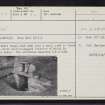
Holy Well: Steps lead down into a small yard in front of a stone built well-house, the interior of which is filled with water. The structure measures 2.5 x 5.0m overall.
Visited by OS (JLD) 17 October 1956
As described above.
Visited by OS (WDJ) 29 May 1964
This well, situated in the outer cemetery in the Cathedral grounds, is named Monk's Well by Morris and Morris, who also give a photograph of it. St Cainnech is supposed to have established a small community beside it, possibly because it was a holy spot in pre-Christian days.
R Morris and F Morris 1982.


