Pricing Change
New pricing for orders of material from this site will come into place shortly. Charges for supply of digital images, digitisation on demand, prints and licensing will be altered.
Perth, South Street, Queen's Bridge
Road Bridge (20th Century)
Site Name Perth, South Street, Queen's Bridge
Classification Road Bridge (20th Century)
Alternative Name(s) River Tay; New Bridge
Canmore ID 79821
Site Number NO12SW 264
NGR NO 12166 23433
Datum OSGB36 - NGR
Permalink http://canmore.org.uk/site/79821
- Council Perth And Kinross
- Parish Perth
- Former Region Tayside
- Former District Perth And Kinross
- Former County Perthshire
NO12SW 264 12166 23433
Location formerly cited as NO 1211 2343 to NO 1221 2342.
Formerly also entered as NO12SW 264 'New Bridge' at cited location NO 1217 2343.
Not to be confused with Perth (Smeaton's) Bridge (NO 1212 2387), for which see NO12SW 149.
For (predecessor) Stanners Island Bridge (NO 1213 2372), see NO12SW 77.
Queen's Bridge [NAT]
OS 1:10,000 map, 1994.
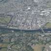
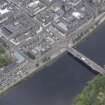
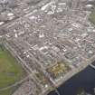
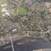
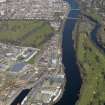
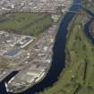
This bridge carries the A93 public road over the River Tay between Perth (to the W) and Bridgend (to the E), and to the S (downstream) of Stanners Island (The Stanners). It thus forms an eastwards continuation of South Street.
The river here forms the boundary between the parishes of Perth (to the W) and Kinnoull (to the E).
The location assigned to this record defines the midpoint of the structure. The available map evidence indicates that it extends from NO c. 12108 23438 to NO c. 12220 23429.
Information from RCAHMS (RJCM), 31 May 2006.
Construction (1960)
The first long span prestressed concrete structure in Scotland.
R Paxton and J Shipway 2007
Project (2007)
This project was undertaken to input site information listed in 'Civil engineering heritage: Scotland - Lowlands and Borders' by R Paxton and J Shipway, 2007.
Publication Account (2009)
Traffic conditions were improved with the opening in 1960 of Queen’s Bridge, the first long span pre-stressed concrete structure in Scotland, which cost £150 000. Its 78 ft, 157 ft and 11 ft spans were adopted to suit the four-span Victoria Bridge it replaced on the same line, which was jacked up to clear the new work by 20 in. and to support the formwork for the new bridge. The consulting engineers were F. A. Macdonald & Partners and the contractor, Whatlings Ltd.
R Paxton and J Shipway
Reproduced from 'Civil Engineering heritage: Scotland - Lowlands and Borders' with kind permission of Thomas Telford Publishers.


