
Pricing Change
New pricing for orders of material from this site will come into place shortly. Charges for supply of digital images, digitisation on demand, prints and licensing will be altered.
Upcoming Maintenance
Please be advised that this website will undergo scheduled maintenance on the following dates:
Thursday, 9 January: 11:00 AM - 3:00 PM
Thursday, 23 January: 11:00 AM - 3:00 PM
Thursday, 30 January: 11:00 AM - 3:00 PM
During these times, some functionality such as image purchasing may be temporarily unavailable. We apologise for any inconvenience this may cause.
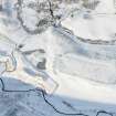
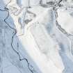
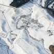
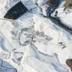
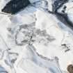
Fendoch


Farmstead (Period Unassigned)
Site Name Fendoch
Classification Farmstead (Period Unassigned)
Canmore ID 140542
Site Number NN92NW 42
NGR NN 9171 2837
Datum OSGB36 - NGR
Permalink http://canmore.org.uk/site/140542


- Council Perth And Kinross
- Parish Fowlis Wester
- Former Region Tayside
- Former District Perth And Kinross
- Former County Perthshire
Note
A farmstead, comprising two unroofed buildings and a wall is depicted on the 1st edition of the OS 6-inch map (Perthshire 1867, sheet lxxxiv). One unroofed building and the wall are shown on the current edition of the OS 1:10000 map (1978).
Information from RCAHMS (AKK) 22 December 1997.

