
Pricing Change
New pricing for orders of material from this site will come into place shortly. Charges for supply of digital images, digitisation on demand, prints and licensing will be altered.
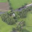
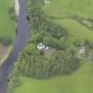
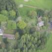
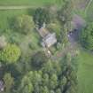
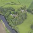
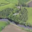
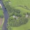
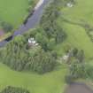
Innerpeffray Burial Ground


Burial Ground (Medieval)
Site Name Innerpeffray Burial Ground
Classification Burial Ground (Medieval)
Alternative Name(s) Churchyard
Canmore ID 233790
Site Number NN91NW 7.01
NGR NN 90210 18348
Datum OSGB36 - NGR
Permalink http://canmore.org.uk/site/233790


- Council Perth And Kinross
- Parish Crieff
- Former Region Tayside
- Former District Perth And Kinross
- Former County Perthshire
Note (27 September 2024)
A church is depicted on the 1st edition of the OS 6-inch map (1866).
Information from HES (D Watson) 27 September 2024

