
Pricing Change
New pricing for orders of material from this site will come into place shortly. Charges for supply of digital images, digitisation on demand, prints and licensing will be altered.
Castle Menzies, Garden


Garden (Period Unassigned)
Site Name Castle Menzies, Garden
Classification Garden (Period Unassigned)
Canmore ID 68186
Site Number NN84NW 63
NGR NN 8376 4961
Datum OSGB36 - NGR
Permalink http://canmore.org.uk/site/68186


- Council Perth And Kinross
- Parish Weem
- Former Region Tayside
- Former District Perth And Kinross
- Former County Perthshire
Geophysical Survey (5 July 2001 - 9 July 2001)
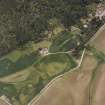
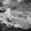
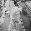
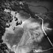
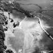
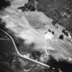
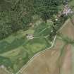
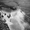
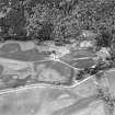
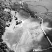
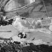
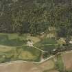
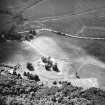
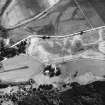
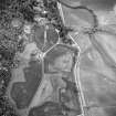
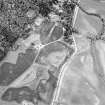
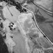
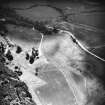
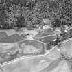
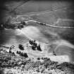
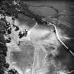
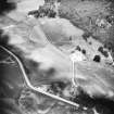
SUAT Ltd and CFA Archaeology Ltd were commissioned by the BBC to conduct a programme of archaeological fieldwork to the east of Castle Menzies, Aberfeldy. The investigation was to form the basis of a BBC pilot programme. Aerial photographs taken by of the Royal Commission on the Ancient and Historical Monuments of Scotland (RCAHMS) and by David MacLeod of English Heritage indicated the presence of a rectilinear feature in the fields immediately to the east of the castle. Geophysical survey comprising both Fluxgate Gradometer and Resistivity survey was conducted. The results these surveys largely colluded with the map evidence and the aerial photographic evidence. Four trenches were excavated across anomalies chosen from the aerial photographs and the geophysical survey results.The results of the excavation indicate that this area was indeed the site of a walled garden as depicted on the Pont Map of 1580.
SUAT 2001

