
Pricing Change
New pricing for orders of material from this site will come into place shortly. Charges for supply of digital images, digitisation on demand, prints and licensing will be altered.
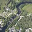
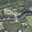
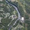
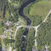
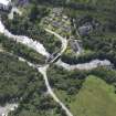
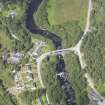
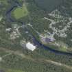
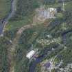
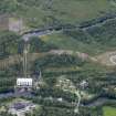
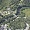
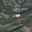
Tummel Bridge, New Bridge


Road Bridge (Period Unassigned)
Site Name Tummel Bridge, New Bridge
Classification Road Bridge (Period Unassigned)
Alternative Name(s) River Tummel
Canmore ID 171420
Site Number NN75NE 81
NGR NN 7624 5919
Datum OSGB36 - NGR
Permalink http://canmore.org.uk/site/171420


- Council Perth And Kinross
- Parish Dull
- Former Region Tayside
- Former District Perth And Kinross
- Former County Perthshire
NN75NE 81 7624 5919
For adjacent (to SE) Old Bridge, see NN75NE 28.
This bridge carries the present line of the B846 public road over the River Tummel to the W of Loch Tummel and of Tummel Bridge village (NN75NE 75). The river here forms the boundary between the parishes of Dull (to the S) and Blair Atholl (to the N).
Information from RCAHMS (RJCM), 27 October 2000.

