
Pricing Change
New pricing for orders of material from this site will come into place shortly. Charges for supply of digital images, digitisation on demand, prints and licensing will be altered.
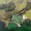
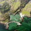
Eigg, Galmisdale


Farmstead (Post Medieval)
Site Name Eigg, Galmisdale
Classification Farmstead (Post Medieval)
Canmore ID 118021
Site Number NM48SE 31
NGR NM 4830 8383
Datum OSGB36 - NGR
Permalink http://canmore.org.uk/site/118021


- Council Highland
- Parish Small Isles
- Former Region Highland
- Former District Lochaber
- Former County Inverness-shire
NM48SE 31 4830 8383
A farmstead, comprising one roofed, one unroofed building and one enclosure is depicted on the 1st edition of the OS 6-inch map (Inverness-shire Island of Eigg 1880, sheet lxxiii). Two roofed buildings and one enclosure are shown on the current edition of the OS 1:10000 map (1976).
Information from RCAHMS (AKK) 9 December 1996.
NM 4830 8395 An archaeological evaluation was undertaken prior to the excavation of foundations for a proposed dance studio. The evaluation consisted of a desk-based search, followed by a physical evaluation of the site by trial trenching. The area assessed measured 14 meters N - S by 8 meters E - W. Although the development site lies within a landscape containing much extant evidence for activity in the prehistoric period, not a trace of archaeological features or artefacts were found on the excavated site.
M Wildgoose, 2007
Field Visit (6 July 2001)
The roofed cottage depicted here on the 1st edition of the OS 6-inch map (Island of Eigg Inverness-shire 1880, Sheet lxxiii) is inhabited and an adjacent building (roofless in 1880) is currently used as a bothy. To the NE of the bothy are several small quarries.
Visited by RCAHMS (AGCH) 6 July 2001

