Pricing Change
New pricing for orders of material from this site will come into place shortly. Charges for supply of digital images, digitisation on demand, prints and licensing will be altered.
Upcoming Maintenance
Please be advised that this website will undergo scheduled maintenance on the following dates:
Thursday, 9 January: 11:00 AM - 3:00 PM
Thursday, 23 January: 11:00 AM - 3:00 PM
Thursday, 30 January: 11:00 AM - 3:00 PM
During these times, some functionality such as image purchasing may be temporarily unavailable. We apologise for any inconvenience this may cause.
Mull, Camas Tuath
Quarry (Period Unassigned)
Site Name Mull, Camas Tuath
Classification Quarry (Period Unassigned)
Alternative Name(s) North Bay; Skerryvore And Ardnamurchan Lighthouses, Quarry
Canmore ID 21756
Site Number NM32SE 16
NGR NM 3520 2424
Datum OSGB36 - NGR
Permalink http://canmore.org.uk/site/21756
- Council Argyll And Bute
- Parish Kilfinichen And Kilvickeon
- Former Region Strathclyde
- Former District Argyll And Bute
- Former County Argyll
NM32SE 16 3520 2424
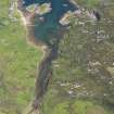
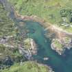
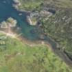
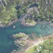
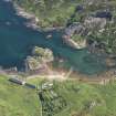
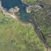
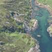
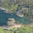
This quarry extends some 40m across the face of the steep slope above the E shore of Camas Tuath. The quarry-floor is about 28m above high-water mark, and the main working-face, which bears numerous drill-holes, is exposed to an average height of about 18m. The rock is a coarse-grained pink granite, and stone from this source was used in the construction of Skerryvore and Ardnamurchan Lighthouses [NL82NW 1 and NM46NW 4 respectively], the quarry having been first opened specifically for this purpose in April 1839. The material was lowered in wagons down a steep incline from the quarry-floor to a wharf on the shore of the bay, and thence, in the case of the Skerryvore operations, the rough blocks were shipped to the workyard at Hynish on Tiree. The ramp and the jetty may still be seen, and there are vestiges of the railway-track at the foot of the incline. The ruinous shell of a small building which probably served as a smithy or forge stands a short distance to the N of the jetty, while on the opposite shore of the bay (NM 349 243) there is a single and a two-storeyed terraced row of quarriers' dwellings. The two-storeyed N block was evidently divided into flats, and may be identified as the 'range of barracks, capable of accommodating forty persons' that was completed by August 1839.
A Stevenson 1848; RCAHMS 1980, visited September 1976.
Four unroofed buildings, four roofed buildings, one of which is annotated as a Smithy, and two cranes are depicted on the 1st edition of the OS 6-inch map (Argyllshire, Island of Mull 1882, sheet cv).
Five unroofed buildings and one roofed building are shown on the current edition of the OS 1:10000 map (1976).
Information from RCAHMS (SAH), 28 July 1998.


