
Broomend Of Crichie North


Cairn (Period Unassigned)
Site Name Broomend Of Crichie North
Classification Cairn (Period Unassigned)
Canmore ID 18632
Site Number NJ71NE 7
NGR NJ 7793 1975
Datum OSGB36 - NGR
Permalink http://canmore.org.uk/site/18632


- Council Aberdeenshire
- Parish Kintore
- Former Region Grampian
- Former District Gordon
- Former County Aberdeenshire
NJ71NE 7 7793 1975.
(NJ 7793 1975). The site of the northern circle, a probable cairn circle, in the Crichie complex is now occupied by a sandpit but Maitland (1757) described it just before 1757 as three concentric rows of erect stones with a small cairn in the middle. Nearby there is said to have been a flat altar-stone, with a cavity in the upper part, raised on a rough cairn.
J Ritchie 1920; W Maitland 1757.
There are no extant remains of this cairn circle.
Visited by OS (RD) 10 March 1964.
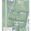
The indicated location falls within a derelict sandpit on a broad undulating terrace at an altitude of about 60m OD.
NMRS, MS/712/67, visited 4 September 1980.
This cairn has been destroyed; there is no change to the existing record.
Information from RCAHMS (JRS), 25 October 1996.
Publication Account (2011)
In 1693 James Garden briefly described two ‘small ston monuments’ at Broomend of Crichie in a letter to John Aubrey (Hunter 2001, 137), one of which is clearly the well-known henge monument (NJ71NE 6). As he remembered them, each comprised two rings of stones, but whereas the ditch of the henge lay outside the two rings, in the other it was between them. He gives no clue as to where this second monument lay, but it is generally assumed to be the structure that in the mid 18th century William Maitland described to the north of the henge, ‘encompassed with three rows of stones erect, with a small cairn or heap in the middle’ (1757, i, 154). Maitland considered it the larger of the two monuments, and it was approached by an avenue of standing stones that passed through the henge. While the henge and several standing stones have survived, this monument at the northern terminal of the avenue has been destroyed, probably when the Aberdeen turnpike was constructed just before 1800 (Ritchie 1920, 169–71). It is shown as a disc of stipple on an estate map of the Barony of Crichie dating from 1780 (Ritchie 1920, 162, fig 4) and its site now falls in a disused sand-pit. Although Burl has suggested that this monument may have been a recumbent stone circle (1995, 97; 2000, 419, Abn 17a; 2005a, 97, 285), Maitland’s only reference to an altar stone, the contemporary term for a recumbent, is circumspect in comparison to his description of the rest of the himself. He describes it as if it was a separate structure: ‘near to this [ie the monument at the north end of the avenue] there is said to have been an altar of one stone, with a cavity in the upper part,…This altar for burnt offerings, like those of other temples, was an artificial heap, or cairn, of rough unwrought stones, with a large flat stone on the upper part’ (1757, i, 154). Whether or not this group of monuments ever included a recumbent stone circle is unlikely to be resolved, but in the light of what survives of the prehistoric monumental vocabulary in the north-east of Scotland, the description of three concentric rings of upright stones best fits a circle of orthostats enclosing a ring-cairn with well-defined inner and outer kerbs.

