Pricing Change
New pricing for orders of material from this site will come into place shortly. Charges for supply of digital images, digitisation on demand, prints and licensing will be altered.
Old Rayne
Cup Marked Stone (Prehistoric), Recumbent Stone Circle (Neolithic) - (Bronze Age)
Site Name Old Rayne
Classification Cup Marked Stone (Prehistoric), Recumbent Stone Circle (Neolithic) - (Bronze Age)
Alternative Name(s) Candle Hill; Tap O' Mast
Canmore ID 18081
Site Number NJ62NE 1
NGR NJ 6798 2798
Datum OSGB36 - NGR
Permalink http://canmore.org.uk/site/18081
- Council Aberdeenshire
- Parish Rayne
- Former Region Grampian
- Former District Gordon
- Former County Aberdeenshire
NJ62NE 1 6798 2798.
(NJ 6798 2798) Stone Circle (NR) Urns found.
OS 6" map, (1959)
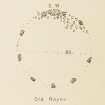
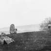
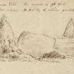
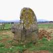
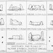
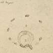
A recumbent stone circle, previously known as Tap o' Mast. Before Dalrymple's excavation moved them in 1856-7, there were twelve stones forming a circle nearly 60ft (18.3m) in diameter, with the recumbent, its two pillars, and a fourth slab arranged to form two sides of a parallelogram, whose other two sides had traditionally been dry stone walls. This arrangement may have been caused by the district Head Courts held here in medieval times. All that remained in 1902 were the prostrate recumbent stone, the two broken and displaced flankers, and six other blocks, only one of which was in situ.
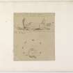
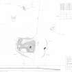
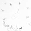
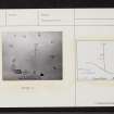
The excavation revealed a central, oblong layer of stones 2 1/2ft (0.76m) deep, in which was a pit 2ft (0.6m) in diameter containing burnt bones; charcoal; fragments of an urn; and part of a polished stone wrist guard. Other small deposits of bones occured around and within 2ft (0.6m) of this pit. The contents of another pit 5ft (1.5m) deep, between the E pillar and stone H (see plan), included black mould and fire-marked boulder stones.
A stone cup, minus handle, was found about 1895, and in 1902 an urn was discovered containing what was possibly burnt bones, but it was broken by the spade.
Callander (1935) mentions cup marks on the recumbent stone.
F R Coles 1902; J G Callander 1935; J Stuart 1856.
A mutilated recumbent stone circle as described and planned by Coles (1902). It has been ploughed through but no further finds are reported. The recumbent stone has at least three weathered cup marks on it, and there is a cupmark on stone 'D'.
Re-surveyed at 1/2500.
Visited by OS (NKB) 11 March 1969.
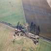
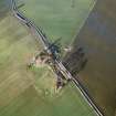
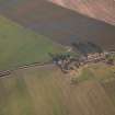
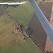
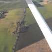
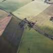
Air photographs: AAS/00/12/G30/8-10 and AAS/00/12/CT.
NMRS, MS/712/100.
Field Visit (23 June 1999)
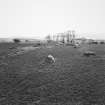
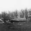
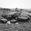
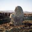
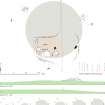
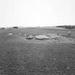
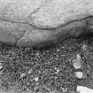
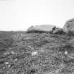
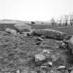
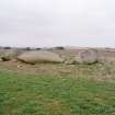
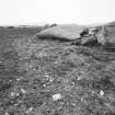
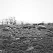
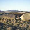
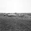
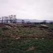
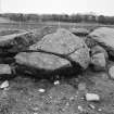
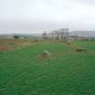
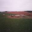
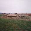
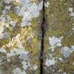
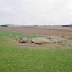
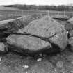
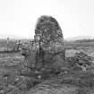
The wreck of this recumbent stone circle lies on the NE side of the public road a little to the E side of the summit of Candle Hill, a low ridge overlooking the River Urie to the SE of Old Rayne. In the early 19th century, when James Skene measured it, the circle comprised at least ten stones, but today only eight remain, all bar one lying flat around the edges of a low swelling some 26m across. The recumbent (2), a large trapezoidal slab measuring up to 3.85m in length by 2.1m in breadth, has fallen onto its back on the S side of the ring and what was its even summit now forms the N side. There is at least one weathered cupmark near the centre of its upturned face, while three possible examples are arranged in a rough arc near its S side and would formerly have been at the foot of the stone; the only other cupmarks on the ring are three faint examples on the southern fragment of the W flanker (1) and another on the tip of the orthostat on the NNW (6). The two flankers, both of which are now about 2.75m in length, have suffered at the hands of stone-breakers and are lying prostrate (1 & 3). Indeed, the western has been split into at least two pieces since 1901 and comparison with the measurement of 3.3m in overall length taken by Coles in that year suggests that other pieces may be missing; work on removing a further fragment from the W edge of the S section was evidently abandoned before the task was completed. The N section exhibits the deeply cut initials GF. A wedge-socket at the E end of the eastern flanker (3) suggests that this too has been cut down. The single orthostat that remains standing is on the SE (4) and has had a lucky escape, as can be seen from the iron wedges embedded in several of the fissures in its outer face; moreover, its profile shows that at least two large chunks of rock have been removed from its WSW side. Of the other four orthostats (5–8 ), at least one (8) is displaced, now lying immediately N of the W flanker, and it is not clear how close to their sockets the other three lie; the earliest record of the diameter of the circle by James Skene is in the order of 15.5m, while Charles Dalrymple put it at about 18m, both considerably less than the circle of 26.5m that best fits the stones in their present positions. This bigger diameter, however, coincides with a swelling in the surface of the field revealed by profiles measured across the ring, particularly that from N to S (X–X1). Despite the complete absence of any cairn material in the plough-soil in the interior of the circle, this swelling is likely to be an artificial mound, within which Charles Dalrymple discovered a large central pit; the stones of the circle apparently stood upon the skirts of this mound (see discussion below). The purpose of a deeply embedded boulder (A) behind the E flanker is not known. It possibly belonged to a later structure that once incorporated the recumbent setting (below).
Visited by RCAHMS (ATW and KHJM) 23 June 1999


