
Pricing Change
New pricing for orders of material from this site will come into place shortly. Charges for supply of digital images, digitisation on demand, prints and licensing will be altered.
Peel Of Fichlie


Motte And Bailey (Medieval)
Site Name Peel Of Fichlie
Classification Motte And Bailey (Medieval)
Alternative Name(s) Glaschul Hill; River Don
Canmore ID 17137
Site Number NJ41SE 7
NGR NJ 4600 1390
Datum OSGB36 - NGR
Permalink http://canmore.org.uk/site/17137


- Council Aberdeenshire
- Parish Towie
- Former Region Grampian
- Former District Gordon
- Former County Aberdeenshire
NJ41SE 7 4600 1390
(NJ 4600 1390) Peel of Fichlie (NR) Fosse (NR)
OS 6" map, Aberdeenshirem, 2nd ed., (1902)
Peel of Fichlie, a fine and well-preserved example of a motte and bailey castle stands at about 750ft OD between Glaschuil Hill and the River Don.
The motte stands between two deep dens on the N and S, which unite in the E below the motte, thus leaving a triangular cape of ground to form the bailey, which is about 75ft E to W by 150ft transversely, and is isolated from the motte by a transverse ditch about 4ft deep and 30ft broad at top. The area on the motte, 30ft above the den, is about 145ft in diameter and is enclosed by a raised stony bank 3ft broad, 1ft 4ins maximum height.
Alan Durward obtained control of a large portion of the Earldom of Mar in 1228 and it is likely that the Peel of Fichlie was built after this to guard the northern territories.
Information from Simpson, WD Scottish Notes and Queries, 3rd Ser, Vol.7, 22-3, plan.
Peel of Fichlie, generally as described as Simpson. The bank on the top of the motte can now only be traced on the northern arc and is reduced to c.0.3m high.
Surveyed at 1/2500.
Visited by OS (R L) 29 August 1968.
Air photographs: AAS/84/13/R27/4-6, AAS/94/03/G5/12-13 and CUCAP BVH 077.
NMRS, MS/712/21 and MS/712/46.
The Peel of Fichlie is a roughly square motte, measuring some 40m across the summit, and standing to a height of 9m on the NW and 6m on the SE. A bank around the lip of the motte on the NE side is probably a relatively late agricultural bank, although a low internal scarp around the NW and SE creates the impression that the summit is slightly dished, suggesting the possible presence of an earlier but now ploughed-down bank. There is a shallow ditch 10m broad around the base of the motte on the NE and SE sides, though this too has been much reduced by ploughing, and on the SE appearing as little more than a terrace. Natural gullies flanking the site offer additional protection, but there is no visible evidence to suggest that the gently sloping spur of ground to the E was used as a bailey.
Visited by RCAHMS (PC, IF, SS), 27 June 1996.
Scheduled as Peel of Fichlie, motte.
Information from Historic Scotland, scheduling document dated 4 February 2003.
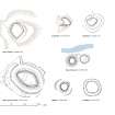
Resistivity (July 1999)
Survey_Report The survey shows a high resistance encircling the Motte, however this may simply be the ground geometry effect at the edge of the slope. At the SE corner there are two distinct lows running SE for 7m which may suggest filled in drainage channels. The north edge has some high resistance features suggestive of wall tumble. In the central area there are several high resistance features that also may indicate building footings extending over an area of 25m x 20m. The evidence is inconclusive. However, given the historic evidence of a Motte feature here, then a trial trench may be productive in establishing the archaeological potential. One percent of the area is 16 sq. m and two 8m x 1m trial trenches are suggested, on the central features.

