Pricing Change
New pricing for orders of material from this site will come into place shortly. Charges for supply of digital images, digitisation on demand, prints and licensing will be altered.
Tor Castle
Castle (Medieval)
Site Name Tor Castle
Classification Castle (Medieval)
Alternative Name(s) Castle Of Dallas
Canmore ID 16103
Site Number NJ15SW 1
NGR NJ 1253 5300
Datum OSGB36 - NGR
Permalink http://canmore.org.uk/site/16103
- Council Moray
- Parish Dallas
- Former Region Grampian
- Former District Moray
- Former County Morayshire
NJ15SW 1 1253 5300
(NJ 1253 5300) Tor Castle (NR) (Ruin), Tower (NR)
(Site of), Gateway (NR) (Site of),
Ditch (NR) (Site of)
OS 6"map, Morayshire, 2nd ed., (1906)
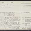
The erection of 'Tor Castle' or the 'Castle of Dallas' was authorised in 1419. It was probably erected about the mid-15th century by Robert Cochrane, the court architect; and was enlarged periodically until the mid-17th century, when it was abandoned.
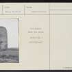
A fragment of the NW wall stands 30' high, but the rest is destroyed. The walls are 7' thick, of good but not elegant masonry. The site of a tower at the SE angle was traceable in 1871.
The entrance and drawbridge of the castle faced east, over a moat which is said to have been paved with stone flags. The moat can still be traced.
Name Book 1871; ISSFC 1888; H B Mackintosh 1924; R Douglas 1928.
Parts of the north and west walls of the tower still remain and the NW angle still stands to a height of about 30'. The gateway and drawbridge are no longer visible, while the moat, which was filled in in 1955, is only vaguely visible to the south of the drain bisecting the site.
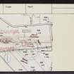
Castle and mound resurveyed at 1/2500
Revised at 1/2500.
Visited by OS (R D) 23 July 1965.
EXTERNAL REFERENCE:
National Library of Scotland
Nattes Drawings
1 Drawing, 17 Sept. Vol II no.50 - 1 Drawing


