Scheduled Maintenance
Please be advised that this website will undergo scheduled maintenance on the following dates: •
Tuesday 3rd December 11:00-15:00
During these times, some services may be temporarily unavailable. We apologise for any inconvenience this may cause.
Nigg Battery
Coastal Battery (Second World War)
Site Name Nigg Battery
Classification Coastal Battery (Second World War)
Alternative Name(s) Cromarty Defences; Dunskeath Castle; Norwegian Battery; Fort Nigg
Canmore ID 80309
Site Number NH86NW 10
NGR NH 80520 69020
NGR Description NH 80520 69020 and NH 80495 69037
Datum OSGB36 - NGR
Permalink http://canmore.org.uk/site/80309
- Council Highland
- Parish Nigg (Ross And Cromarty)
- Former Region Highland
- Former District Ross And Cromarty
- Former County Ross And Cromarty
NH86NW 10.00 80520 69020 and 80495 69037
NH86NW 10.01 centred NH 8031 6897 Military Camp
NH86NW 10.02 NH 80702 68960 Observation Post
NH86NW 10.03 NH 80596 68917 Searchlight Emplacement
NH86NW 10.04 NH 80587 68916 Weapons Pit (Possible)
NH86NW 10.05 NH 80588 68929 Building Platform
NH86NW 10.06 NH 80561 69013 Weapons Pit
NH86NW 10.07 NH 80547 69012 Observation Post
NH86NW 10.08 NH 80514 69031 Weapons Pit
NH86NW 10.09 centred NH 80507 69026 Gun Emplacements
NH86NW 10.10 NH 80433 68990 Weapons Pit
NH86NW 10.11 NH 80342 68942 Building
NH86NW 10.12 NH 80355 68936 Building Platform
NH86NW 10.13 NH 80316 68923 Building (Possible)
NH86NW 10.14 NH 80311 68972 Building Platform
NH86NW 10.15 NH 80310 68977 Building Platform
NH86NW 10.16 NH 80307 68937 Nissen Hut
NH86NW 10.17 NH 80295 68965 Nissen Hut
NH86NW 10.18 NH 80243 68946 Engine House
NH86NW 10.19 NH 80231 68926 Building Platform
NH86NW 10.20 NH 80211 68916 Nissen Hut
NH86NW 10.21 NH 80558 69047 Rocket Projector Battery (Possible)
NH86NW 10.22 NH 80531 69053 Magazine
NH86NW 10.23 NH 80528 69117 Magazine
NH86NW 10.24 NH 80508 69124 Weapons Pit
NH86NW 10.25 NH 80495 69113 Weapons Pit
NH86NW 10.26 NH 80497 69108 Weapons Pit
NH86NW 10.27 NH 80495 69101 Trench
NH86NW 10.28 NH 80502 69070 Gun Crew Accommodation
NH86NW 10.29 NH 80484 69082 Magazine
NH86NW 10.30 NH 80418 69051 Weapons Pit (Possible)
NH86NW 10.31 NH 80415 69063 Weapons Pit (Possible)
NH86NW 10.32 NH 80387 69059 Weapons Pit (Possible)
NH86NW 10.33 NH 80311 69099 Weapons Pit (Possible)
NH86NW 10.34 NH 80298 68994 Ablutions Block
NH86NW 10.35 NH 80280 68996 Nissen Hut
NH86NW 10.36 NH 80266 68999 Nissen Hut
NH86NW 10.37 NH 80250 68991 Nissen Hut
NH86NW 10.38 NH 80250 68991 Nissen Hut
NH86NW 10.39 NH 80235 68979 Nissen Hut
NH86NW 10.40 NH 80208 68830 Searchlight Emplacement
NH86NW 10.41 NH 80289 69035 Road
NH86NW 10.42 NH 80580 69069 Weapons Pit
NH86NW 10.43 NH80360 68962 Engine House
NH86NW 10.44 NH 80292 68976 Nissen Hut
NH86NW 10.45 NH 80274 68967 Nissen Hut
NH86NW 10.46 NH 80260 68967 Nissen Hut
NH86NW 10.47 NH 80317 68938 Building
NH86NW 10.48 NH 80351 68946 Building
NH86NW 10.49 NH 80329 69020 Latrines
NH86NW 10.50 NH 80276 69017 Latrines
NH86NW 10.51 NH 80200 68990 Trenches
NH86NW 10.52 NH 80184 68969 Guardhouse
NH86NW 10.53 NH 80205 68970 Building Platform
NH86NW 10.54 NH 80222 68970 Building Platform
NH86NW 10.55 NH 80186 68946 Building Platform
NH86NW 10.56 centred NH 80390 69030 Defences
NH86NW 10.57 NH 80267 69021 Nissen Hut
3 buildings probably WWII bunkers or gun emplacements, destroyed into piles of concrete, brick and metal (many of Hunter: Brora bricks). Possible shell middens c. 50m to SW. 2 mounds 10-15m apart - stable and bracken cover.
CFA/MORA Coastal Assessment Survey 1998.
Previously recorded at NH 8052 6698 was in error. Air photographs (J. Dewar 1972) position the various elements of the monument between NH 8048 6909 to NH 8070 6896.
Information from RCAHMS (AKK). 18 February 2000.
This coast battery is situated near the site of Dunskeath Castle on the S side of the road which runs to North Sutor. The two gun-emaplacements and the battery observation post have been deliberately pulled down and now lie as heaps of broken concrete.
The battery was known locally as the Norwegian Battery. It was armed with 2 x 6-inch Mk.XII guns on Mk.IX mountings which were installed in June 1940. The guns were placed on a care and maintainance basis in 1945.
J Guy 2000; NMRS MS 810/10, Vol.2, 125, Vol.3, 45
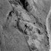
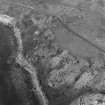
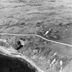
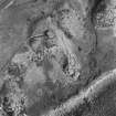
The coast battery is visible on RAF vertical air photographs (106G/UK 751, 6038-6039, flown 31 August 1945) which shows the two gun-emplacements, observation post, magazine, searchlight platform and one Nissen hut.
Information from RCAHMS, October 2004.


