Pricing Change
New pricing for orders of material from this site will come into place shortly. Charges for supply of digital images, digitisation on demand, prints and licensing will be altered.
Long Wood
Mound(S) (Period Unassigned), Site (Period Unassigned)
Site Name Long Wood
Classification Mound(S) (Period Unassigned), Site (Period Unassigned)
Alternative Name(s) Longwood; Baile Na Sith
Canmore ID 116622
Site Number NH54NW 45
NGR NH 535 454
Datum OSGB36 - NGR
Permalink http://canmore.org.uk/site/116622
- Council Highland
- Parish Kirkhill
- Former Region Highland
- Former District Inverness
- Former County Inverness-shire
NH54NW 45 535 454
See also NH54NW 3.
NH 44/54 OS 533454 - 538453 No. 15 Longwood.
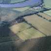
On the south side of the Kirkhill - Dunballoch road, and in the mature fir wood known as Longwood, there are numerous low mounds of various sizes, both circular and oval with faintly discerned surrounding ditches. They are scattered over a large area and one or two overspill into an area of what may have been a previous enclosure at the east side. (see No. 16) Very faint traces of a ditch of medium width can be seen with difficulty running North -South; it is a short distance in from the corner OS 538453. This ditch is unconnected with forestry drainage. Some of the mounds may be in the area known as Baile na Sith mentioned in the Transactions of the Inverness Field Club Volume II page 235. This area is multi-period, being situated above the Stockford of Ross. This dry level plateau was a noted camping site for armies from Viking to Hanoverian times. Alexander I put down a Celtic uprising in a battle believed to have been fought in the vicinity of the Stockford of Ross in 1110. There is what may be a post-Culloden turf wall at the north and east side of this area, parallel to the public road and estate track respectively.
Coghill et al 1989


