Scheduled Maintenance
Please be advised that this website will undergo scheduled maintenance on the following dates: •
Tuesday 3rd December 11:00-15:00
During these times, some services may be temporarily unavailable. We apologise for any inconvenience this may cause.
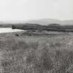
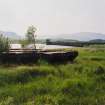
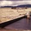
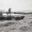
Loch Mhor, Dam
Dam (20th Century)
Site Name Loch Mhor, Dam
Classification Dam (20th Century)
Alternative Name(s) River Gourag; Boleskine; Loch Garth; Foyers Hydro-electric Scheme
Canmore ID 12520
Site Number NH51NW 20
NGR NH 51333 18110
Datum OSGB36 - NGR
Permalink http://canmore.org.uk/site/12520
- Council Highland
- Parish Boleskine And Abertarff
- Former Region Highland
- Former District Inverness
- Former County Inverness-shire
NH51NW 20 51333 18110
Location formerly cited as NH 512 181 to NH 514 180.
For (associated and linked) Foyers Power Station (NH 50306 21774), see NH52SW 41.00.
The dam is visible on vertical air photograph (OS 70/086/029, flown 1970).
Information from RCAHMS (DE), July 1996.
This dam is depicted, but not noted, on the 1976 edition of the OS 1:10,000 map. The available map evidence suggests that it extends from NH c. 51415 18036 to NH c. 51255 18198.
Information from RCAHMS (RJCM), 6 April 2006.
Field Visit (2010)
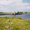
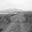
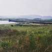
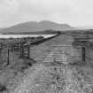
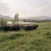
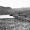
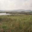
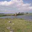
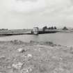
This dam provided the reservoir storage necessary for the powerhouse at Foyers village. The dam raised the level of two smaller lochs to create one large storage reservoir named Loch Mhor. The dam was constructed on concrete, masonry and rammed earth sited directly onto bedrock. The turret contains the original fixtures, including winding gear and sluice gates. The architectural treatment of the dam, which is dressed in rock faced rubble and has a small Crenellated turret to the south end is very similar to that of the powerhouse, and the two are very clearly linked by a common baronial style of design. The sloped rubble wave wall is a particularly good retention. Later alterations include the addition of uPVC windows to the turret and concrete reinforcement to the downstream face of the dam wall as required by the reservoirs act. This dam is an integral part of the development of the Foyers scheme and is functionally related to both the intake and powerhouse. The dam has a good landscape presence with a long low profile and turret. This dam is an integral part of the development of the Foyers scheme and is functionally related to both the intake and powerhouse. The dam has a good landscape presence with a long low profile and turret. The dam was an integral part of the original design raising the water level of two separate lochs to form the single Loch Mhor which acts as storage for the scheme. There is a degree of later alteration to the dam with later windows to the turret and concrete reinforcement to the dam wall as a consequence of the 2008 amendment to the reservoirs act. J R Hume, 1977; P L Payne, 1988; E Wood, 2002; J Miller, 2002.
Note (26 October 2023)
Foyers pumped storage hydro-electric scheme
Like the Loch Awe scheme, Foyers is a pumped storage system. It was a redevelopment of of the previous hydroelectric scheme built by the British Aluminium Company in the late 19th/ early 20th centuries, whose smelter ceased operation in 1967. The upper reservoir, Loch Mhor, had two dams built in its west end and is fed by an aqueduct from the River Fechlin draining Loch Killin. A tunnel connects Loch Mhor and the Foyers power station on the shore of Loch Ness. Nearby ios a second power station, Foyers Falls.
The main construction problem encountered was due to the Great Glen Fault shatter zone, causing routing and tunneling difficulties. Foyers power station has two reversible turbines capable of lifting 160 tons of water per second to Loch Mhor, and outputs 200 tons per second to Loch Ness when generating a full load of 300MW. The scheme was begin in 1969 and completed in 1975.
Information from NRHE item catalogue number WP007424 compiled by George Walker in 2005.


