Scheduled Maintenance
Please be advised that this website will undergo scheduled maintenance on the following dates: •
Tuesday 3rd December 11:00-15:00
During these times, some services may be temporarily unavailable. We apologise for any inconvenience this may cause.
Skye, Rubh' An Dunain
Chambered Cairn (Neolithic), Beaker, Lithic Implement(S) (Quartz), Lithic Implement(S) (Flint), Lithic Implement (Bloodstone), Unidentified Object(S) (Pumice)
Site Name Skye, Rubh' An Dunain
Classification Chambered Cairn (Neolithic), Beaker, Lithic Implement(S) (Quartz), Lithic Implement(S) (Flint), Lithic Implement (Bloodstone), Unidentified Object(S) (Pumice)
Alternative Name(s) Rudh' An Dunain; Soay Sound
Canmore ID 11022
Site Number NG31NE 2
NGR NG 3934 1636
Datum OSGB36 - NGR
Permalink http://canmore.org.uk/site/11022
- Council Highland
- Parish Bracadale
- Former Region Highland
- Former District Skye And Lochalsh
- Former County Inverness-shire
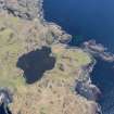
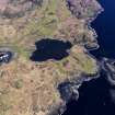
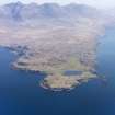
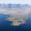
Rubh' an Dunain
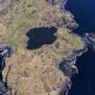
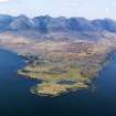
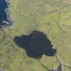
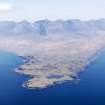
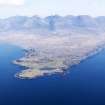
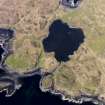
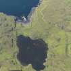
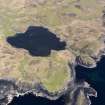
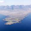
At the toe of this remote promontory, bounded by Loch Brittle and the Sound of Soay and reached only by a lonely track, lies a rich palimpsest of archaeological remains testifying to the former significance of Rubh' an Dunain. Chambered cairn, probably 2nd or 3rd millennium bc, a Neolithic passage grave. To its south, one of best preserved survivals of an Iron Age promontory fort (or galleried dun), with a portion of curved drystone wall to landward, possibly 1st millennium bc. A stone-lined canal, possibly Viking, connects a sheltered inlet to a small lochan, suitable for harbouring birlinns. Small former township, with round-ended ruin of early-mid 18th century tacksman's house, a two-storey chimney gable at one end. Still occupied in the 1860s, this was the home of the MacAskills of Rubh' an Dunain.
Taken from "Western Seaboard: An Illustrated Architectural Guide", by Mary Miers, 2008. Published by the Rutland Press http://www.rias.org.uk
NG31NE 2 3934 1636.
(NG 3934 1636) Chambered Cairn (NR)
OS 6" map, (1965)
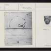
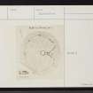
A Hebridean type round cairn with a polygonal chamber with antichamber and short passage, excavated by Scott in 1931-2 and left open.
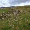
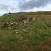
The cairn, of large rounded stones, has a diameter of 62' to 66' and now stands 11' in maximum height. The S side has been heavily robbed, the peristalith and facade on this side being almost entirely destroyed. Where undisturbed, the cairn is covered with turf and heather.
The peristalith, revealed in a number of cuttings, consists of orthostats set 3' to 4' apart and linked with walling. The cairn material extends some 9' beyond the peristalith.
The forecourt is V-shaped in plan and measures about 24' across by 10' deep. Five feet in front of the entrance, there are two slabs lying at right angles to the main axis, the larger being wedged up to give a horizontal surface.
Finds, most of which are in the National Museum of Antiquities of Scotland (NMAS), included an N.4 beaker (EO 382), and from beneath an orthostat of the chamber, a possibly human foundation deposit.
W L Scott 1932; W L Scott 1934; D L Clarke 1970; A S Henshall 1972.
Field Visit (17 May 1915)
Cairn, Loch na h-Airde, Loch Brittle.
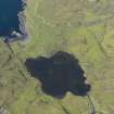
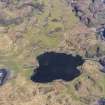
Some 50 yards north of Loch na h-Airde, a lochan lying about 500 yards east of Rudh an Dunain, on the southern side of the mouth of Loch Brittle, at an elevation of some 50 feet above sea-level, is a denuded cairn of stones. The southern half has been considerably reduced in height, but to the north of the centre it still stands 11 feet high. It is now oval on plan, measuring some 76 feet from north to south, and 66 feet from east to west. On the east side are three displaced slabs set on edge, about 3ft in length, and over 2 feet in height, while a fourth is seen near the western edge of the cairn.
RCAHMS 1928, visited 17 May 1915.
OS map: Skye xlix (unnoted).
Publication Account (1985)
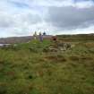
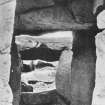
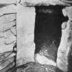
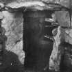
The chambered cairn of Rubh' an Dunain is not conspicuous from a distance, being a low mound largely covered with turf and heather, but it is a very good example of a passage-grave of Hebridean type and well worth the walk. The cairn is almost circular on plan, measuring about 20m in diameter and 3m in height, but on the south-east side the edge has been recessed to form a concave forecourt with the entrance passage at its centre. Several of the kerb-stones of the forecourt remain in position, although some have now fallen, and there are still traces of the drystone walling that originally filled the gaps between the uprights. The passage itself is nearly 3m long and is still lintelled. The outer lintel had slipped a little, but the passage was obviously originally quite low and narrow at the outer end, becoming higher towards the chamber. There is a constriction in the side-walls nearly half-way in. The chamber, now roofless, is almost circular, and is walled by large upright slabs with drystone walling between.
Excavations in 1931 and 1932 showed that the cairn was built of rounded stones, probably from the beach nearby, and surrounded by a low wall of vertical slabs with walling between, similar to the interior. Pottery (including a Beaker), quartz pebbles, flint and quartz chips found in the excavations are in the NMAS. The fragmentary remains of six adults of varying ages were found.
There are several other sites on the same point: 400m to the south-east there is a small dun (NG 395159); also marked on the OS map there is a cave, excavation of which in 1932 revealed Beaker pottery and a later iron forge with slag.
Information from ‘Exploring Scotland’s Heritage: Argyll and the Western Isles’, (1985).


