
Pricing Change
New pricing for orders of material from this site will come into place shortly. Charges for supply of digital images, digitisation on demand, prints and licensing will be altered.
Stain


Pillbox (20th Century)
Site Name Stain
Classification Pillbox (20th Century)
Alternative Name(s) Wic 115
Canmore ID 9350
Site Number ND36SW 25
NGR ND 3447 6028
Datum OSGB36 - NGR
Permalink http://canmore.org.uk/site/9350


- Council Highland
- Parish Wick
- Former Region Highland
- Former District Caithness
- Former County Caithness
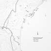
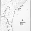
ND36SW 25 3447 6028.
For second pillbox and anti-tank blocks see ND36SW 30 and ND 36SW 38
The base of a World-War II pill-box of standard dimensions, c.4 x 4.5m, located just above HWM.
C E Batey 1984.
The pillbox is visible ona RAF vertical air photograph (106G/Scot/UK73, 4431, flown 9 May 1946) on the seaward side of the row of anti-tank blocks (ND35SW 38). The pillbox was possibly grass-covered.
Information from RCAHMS (DE), October 2004
Project (1980 - 1982)
Field Visit (1984)
The base of a World-War II pill-box of standard dimensions, c.4 x 4.5m, located just above HWM.
C E Batey 1984.
Note (October 2004)
The pillbox is visible ona RAF vertical air photograph (106G/Scot/UK73, 4431, flown 9 May 1946) on the seaward side of the row of anti-tank blocks (ND35SW 38). The pillbox was possibly grass-covered.
Information from RCAHMS (DE), October 2004

