
Scheduled Maintenance
Please be advised that this website will undergo scheduled maintenance on the following dates: •
Tuesday 3rd December 11:00-15:00
During these times, some services may be temporarily unavailable. We apologise for any inconvenience this may cause.
Well Geo


Croft (Period Unassigned)
Site Name Well Geo
Classification Croft (Period Unassigned)
Alternative Name(s) Can 079
Canmore ID 9319
Site Number ND36SE 20
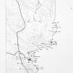
NGR ND 3736 6489
Datum OSGB36 - NGR
Permalink http://canmore.org.uk/site/9319


- Council Highland
- Parish Canisbay
- Former Region Highland
- Former District Caithness
- Former County Caithness
ND36SE 20 3736 6489.
The grass-covered remains of a modern croft comprising two main rooms with a small outhouse at one end and measuring 19.5m NW-SE by 5m by 0.3m to 0.5m high.
C E Batey 1982.
Project (1980 - 1982)
Field Visit (1982)
The grass-covered remains of a modern croft comprising two main rooms with a small outhouse at one end and measuring 19.5m NW-SE by 5m by 0.3m to 0.5m high.
C E Batey 1982.

