Pricing Change
New pricing for orders of material from this site will come into place shortly. Charges for supply of digital images, digitisation on demand, prints and licensing will be altered.
Brounaban
Broch (Iron Age)(Possible), Long Cist (Early Medieval)
Site Name Brounaban
Classification Broch (Iron Age)(Possible), Long Cist (Early Medieval)
Canmore ID 9039
Site Number ND34SW 33
NGR ND 32312 43478
Datum OSGB36 - NGR
Permalink http://canmore.org.uk/site/9039
- Council Highland
- Parish Wick
- Former Region Highland
- Former District Caithness
- Former County Caithness
ND34SW 33 32312 43478
(ND 3231 4347) Broch (NR)
OS 1:10,000 map, (1976)
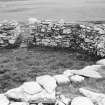
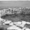
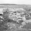
The remains of a broch, excavated by Anderson and Shearer about 1871 and partly restored. The outer face of the wall has not been laid bare but the inner face has been rebuilt to an even height of about 5ft and the interior is in use as a garden. The main entrance has been from the east, through a passage 14ft long, with no guard chamber and no signs of door checks.
A long cist partly of flags and partly built containing a skeleton was found in the interior, and some small finds from the broch are in the National Museum of Antiquities of Scotland (NMAS).
H Dryden 1871; Proc Soc Antiq Scot 1873; RCAHMS 1911.
This broch is generally as described by the RCAHMS: the interior is in use as a sheepfold. Modern walling has sealed entrances to galleries on the N and S.
Resurveyed at 1/2500.
Visited by OS (R L), 19 April 1967.
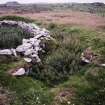
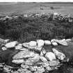
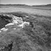
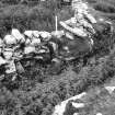
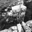
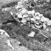
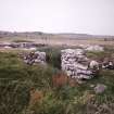
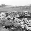
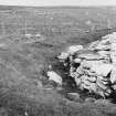
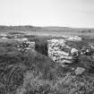
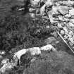
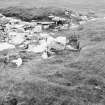
The remains of this broch are situated in low-lying ground 30m E of an 18th century farmsteading (ND34SW 77). The broch, which was excavated in the 19th century, measures 8.5m in diameter within a wall that stands 1.5m in height, though it has evidently been partly reconstructed, and the entrances to intra-mural chambers on the N, W and S have been blocked. The outer face of the wall is masked by grass-grown rubble, but there is an entrance passage on the E measuring 0.95m in width and 2.7m in length. There are no door checks or bar-slots in this passage, which prompted Mercer to suggest (1985, 262-3, no. 230) that it was of relatively modern date and that the original entrance lay on the S. Dryden's plan of the site suggests that there was, indeed, an entrance on the S, with a gallery leading off its E side and a stair off its W. Although each of the chambers has been excavated, they have remained open and details of their construction are now hidden by collapsed rubble and vegetation. On the date of visit the interior was choked with nettles and no internal features were noted.
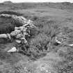
The 'chamber' depicted on Dryden's plan is situated outside the S side of the broch and is apparently built into the rubble of its collapse. It comprises three stones, two of them squat upright slabs set 1.3m apart, and the third an earth-fast stone. Its date and purpose are unknown.
(YARROWS04 368)
Visited by RCAHMS (JRS), 30 June 2004.
Publication Account (2007)
ND34 2 BROUNABAN ('Bronnaben') ND/3231 4347 (visited 11/7/85)
Solid-based probable broch in Wick, Caithness, explored perfunctorily by Joseph Anderson and Robert I. Shearer in about 1871 [2, 3] but only briefly reported on without any plan [3] (this exploration is not one of Joseph Anderson’s best efforts, even by the standards of the time: compare Samuel Laing’s careful work, e.g. on the Keiss brochs. The omission of any kind of plan is difficult to forgive, especially as his contemporary work at Yarrows was much better reported). The project was carried out for the Rhind excavation committee at the same time as the work at the broch of Yarrows (ND34 15). The name is now pronounced locally 'Brown-ay-bun' though apparently differently in Anderson's day [3]. This broch is of interest because it appears to contain two primary intra-mural stairs – a very rare phenomenon.
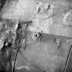
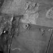
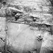
The site is on a low mound in a cultivated field in an otherwise flat landscape; the mound itself shows some wallfaces, suggesting that it may be a ‘tel’ on which the broch was built [6]. It is clear that the building itself was partly restored after – perhaps long after – the excavation; the upper parts of the low surviving inner wallface are relatively loosely built to a standard height of about 1.5m (5ft). The interior was once used as a garden [4] and is still clear of debris, and the alterations are doubtless connected with this. The most detailed description is by the Royal Commission [4] which mentions features which Anderson omits, but most of the structural features – except parts of the intra-mural gallery – are now hidden again [6]. The outer wallface seems never to have been exposed [2].
The following description combines in-formation obtained, first, during the author's visit in 1985 with, second, by Mercer shortly before and also that by the Royal Commission’s investigator in 1910.
Description
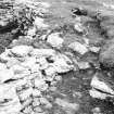
The main entrance is on the east and is about 4.27m (14ft) long (the outer end has been removed); no signs of door-checks or guard chambers were noted by the Com-mission [2] but in fact a broken door-check is clearly visible, made of a slab set on edge into the south side at a distance of 60cm from the inner end. The inner end of this side of the passage is clearly original broch masonry, but the opposite face is all modern re-build. Mercer thought that this passage was modern but the door-check and the residual massive masonry contradict this [6]. The door-frame is so far down the passage that almost certainly there was another one about 2m in from the front end.
The end of a long intra-mural chamber or gallery is 1.83m (6ft) from the right wall of this passage; it has a maximum width of 1.30m (4ft 3in) wide and 4.27m (14ft) long. There is a doorway to the interior (not on Mercer's plan) which is built up and was also in 1910 [4].
Beyond this long cell, at about 2.30 o'clock, there is another doorway 1.07m (3ft 6in) wide leading to an intra-mural stair rising to the right, that is towards the entrance; it therefore rose above the cell just described. This looks wide enough to have required a corbelled roof so presumably the stair rose quickly enough into the vanished Level 2 to avoid this. The steps, now invisible, were seen in 1910. A stair-foot guard cell 3.97m (13ft) long ran back to the left of the door.
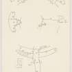
On the opposite side, at 9 o'clock, is a third doorway from the interior into the wall, also 1.07m (3ft 6in) wide, which leads to a second, presumably primary, intra-mural stair which also rises clockwise to the right. Here too is a long stair-foot guard-cell, or length of intra-mural gallery, running to the left of this doorway for 5.19m (17ft) but it is only 60cm (2ft) wide now (Mercer shows it to be much longer, as in the two plans. Another entrance from the outside appears to have passed through the wall at the foot of this stair, but only its east wall was visible in 1910 [4].
At about 11.30 o'clock from the east or main entrance is a fourth doorway (now also blocked up) into the wall, leading to another stretch of wall gallery 1.02m (3ft 4in) wide and 5.19m (17ft) long. The outer wallface has not been properly exposed anywhere.
The central court was found to be paved all over and with a hollow fireplace near the centre; under this pavement was "considerable depth of ashes" [3] as well as a square drain round the fireplace. The remains of a human skeleton were found in one of the stair-foot guard cells, and there was a long cist beside the same stair doorway (presumably in the court) containing another skeleton.
Discussion
It is unfortunate that this broch is so briefly described and also that most of the structural details are now invisible without further excavation. However it does seem, once the available information has been put together, that this is not a ground-galleried broch (as the author once thought) but a relatively slim solid-based one with four long intra-mural cells.
The two intra-mural stairs and two entrances are such unusual features that they demand an explanation [5]. The brochs of Keiss South (ND36 6) and Keiss West (ND36 7) showed these features much more clearly, and to such an extent that – even though the excavations took place many years ago – it is possible to infer in each case that one of the entrances was the original and that the other was driven through the wall (past the base of one of the stairs) much later, probably after the squat towers (if that is what they were) had been substantially demolished. At the Keiss sites on the other hand both stairs seem to have been primary features and this is highly unusual in brochs [5].
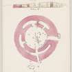
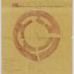
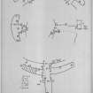
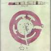
The situation at Brounaban is probably similar, and the eastern entrance seems to be the primary one; it is easier, if a second entrance is needed, to prolong the doorway at the foot of the stair out through the outer third of the wall. This would presumably have been done to the stair at 9 o’clock after much of the high wall of the tower (if it was such) had been pulled down (see Yarrows). Brochs with two primary intra-mural stairs seem to be confined to Caithness. Since no proper plan was made at the time of the excavation, it is not possible to be more precise. The restored plan combines features from Mercer's survey, the Royal Commission's description and the author's observations.
Anderson’s brief account of the interior strongly suggests that the paved floor which he found all over it was a secondary one; deep deposits of ash were found underneath it. This surely implies that Brounaban was occupied for a long time and makes more plausible the inferences just made about drastic changes to the fabric after partial demolition. At this site it should be comparatively easy to re-expose the paved floor of the central court (assuming that Anderson did not lift it all, though the paucity of the finds suggests that he did not) and to explore below it. A primary floor with a ring of post-holes and a lower central hearth might be found.
The restored plan shows two sets of door-checks in the primary entrance and again this is something that could probably be checked quite easily with further excavation. The surviving check is so far down the passage that a second, outer door is implied. Such are known in several other sites in the north-east Mainland.
Finds [2]: these were few – presumably reflecting the rapidity of the exploration suggested by Anderson's brief description.
Stone: 1 “rude mortar stone” 7.5cm (3in) across with a cavity in the top, 2 stone balls about the size of large oranges, 2 hammerstones or pounders and 5 chipped discs of slaty stone 7-10cm (2.75-4in) in diameter.
Dimensions: in 1971 a survey of the central court showed that this had been laid out close to an exact circle with a radius of 4.29 +/- 0.06m (diam. 8.58 m). Mercer gives the internal diameter as 8.7m and the overall diameter at about 16 m.
Sources: 1. NMRS site no. ND 34 SW 33: 2. Proc Soc Antiq Scot 9 (1870-72), 245 (finds): 3. Anderson 1890, 142: 4. RCAHMS 1911b, 152, no. 511: 5. Graham 1947: 6. Mercer 1985, 105, no. WAR 230, and fig. 64.
E W MacKie 2007


