Scheduled Maintenance
Please be advised that this website will undergo scheduled maintenance on the following dates: •
Tuesday 3rd December 11:00-15:00
During these times, some services may be temporarily unavailable. We apologise for any inconvenience this may cause.
Thrumster, Sarclet Decoy Control Bunker
Bunker (20th Century)
Site Name Thrumster, Sarclet Decoy Control Bunker
Classification Bunker (20th Century)
Alternative Name(s) Q/k; Rose Cottage; Mains Of Ulbster, Hillhead
Canmore ID 167151
Site Number ND34SW 311.01
NGR ND 34076 43706
NGR Description ND 34076 43706
Datum OSGB36 - NGR
Permalink http://canmore.org.uk/site/167151
- Council Highland
- Parish Wick
- Former Region Highland
- Former District Caithness
- Former County Caithness
ND34SW 311 34076 43706
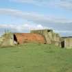
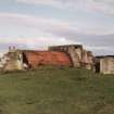
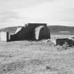
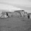
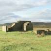
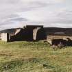
The bunker for generating electricity for the decoy runway lights, is situated on the W side of the road to Mains of Ulbster, adjacent to a new house just N of Rose Cottage. Constructed of brick and concrete, and consisting of three compartments, and has a corrugated iron roof. The earth covering has been partly removed.
The site was a decoy for Wick Airfield (ND35SE 103)
J Guy 2000; NMRS MS 810/10, Vol.1, 16, Vol.3, 18.
The earth covered bunker is visible on the W side of the minor road which runs to Mains of Ulbster about 37m S of Redmyre cottage. The brick and concrete bunker is of two compartments with a corrugated iron roof and steel ladder. There is the remains of an air-raid shelter to the N in the garden of Redmyre cottage.
Visited by RCAHMS (DE, SW), August 2000.
The electricity generating bunker is of the Drem 'Q' and 'K' control shelter type. (The decoy airfield is visible on post-war air photographs, RAF CPE/Scot/UK/225, 3158, flown 27 June 1947). The 'decoy' runways are still visible today and can be seen from the decoy bunker running SW. The pattern of runways are also visible on All Scotland Survey air photographs, (22 87 060-1, flown 7 October 1987).
Information from RCAHMS (DE), May 2001.
This generating bunker, which is a brick and concrete structure of Drem Q design, is situated immediately W of the Thrumster to Mains of Ulbster road and lies near the northern end of the NE to SW runway (ND34SW 311.10). It measures 10.8m from NNE to SSW by 3m overall and is divided into two compartments separated by a passage. The concrete plinths on which the engines were mounted are preserved in the northern compartment. Although each of the compartments of the structure retains its arched corrugated iron sheet roof, most of the external cladding of earth has been removed.
(YARROWS04 455)
Visited by RCAHMS (ATW), 24 August 2004.


