
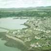
Lewis, Stornoway Harbour, Breakwater


Breakwater (Period Unassigned)
Site Name Lewis, Stornoway Harbour, Breakwater
Classification Breakwater (Period Unassigned)
Canmore ID 153205
Site Number NB43SW 19.02
NGR NB 4285 3215
Datum OSGB36 - NGR
Permalink http://canmore.org.uk/site/153205


- Council Western Isles
- Parish Stornoway
- Former Region Western Isles Islands Area
- Former District Western Isles
- Former County Ross And Cromarty

