
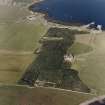
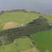
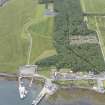
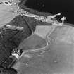
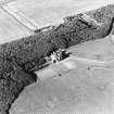
Shapinsay, Balfour Castle, Walled Garden


Walled Garden (Period Unassigned)
Site Name Shapinsay, Balfour Castle, Walled Garden
Classification Walled Garden (Period Unassigned)
Alternative Name(s) Balfour Castle Policies
Canmore ID 175169
Site Number HY41NE 17.02
NGR HY 47697 16558
Datum OSGB36 - NGR
Permalink http://canmore.org.uk/site/175169


- Council Orkney Islands
- Parish Shapinsay
- Former Region Orkney Islands Area
- Former District Orkney
- Former County Orkney
HY41NE 17.02 47697 16558

