 |
On-line Digital Images |
SC 1693623 |
RCAHMS Aerial Photography |
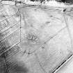
Oblique aerial view centred on the remains of the cairns and rig, taken from the S. |
14/3/2002 |
Item Level |
|
 |
On-line Digital Images |
SC 1693624 |
RCAHMS Aerial Photography |
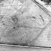
Oblique aerial view centred on the remains of the cairns and rig, taken from the SE. |
14/3/2002 |
Item Level |
|
 |
On-line Digital Images |
SC 1693625 |
RCAHMS Aerial Photography |
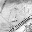
Oblique aerial view centred on the remains of the cairns and rig, taken from the NE. |
14/3/2002 |
Item Level |
|
 |
On-line Digital Images |
SC 1926335 |
Caithness Coastal Survey |
General survey area plan. |
1982 |
Item Level |
|
 |
On-line Digital Images |
SC 1926336 |
Caithness Coastal Survey |
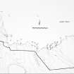
Dunnet Parish Map |
1982 |
Item Level |
|
 |
On-line Digital Images |
SC 1943519 |
Caithness Coastal Survey |
|
1980 |
Item Level |
|
 |
On-line Digital Images |
SC 1943520 |
Caithness Coastal Survey |
|
1980 |
Item Level |
|
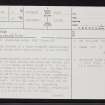 |
On-line Digital Images |
SC 2353909 |
Records of the Ordnance Survey, Southampton, Hampshire, England |
Rattar, ND27SW 3, Ordnance Survey index card, page number 1, Recto |
c. 1958 |
Item Level |
|
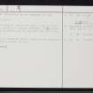 |
On-line Digital Images |
SC 2353910 |
Records of the Ordnance Survey, Southampton, Hampshire, England |
Rattar, ND27SW 3, Ordnance Survey index card, page number 2, Verso |
c. 1958 |
Item Level |
|
 |
On-line Digital Images |
SC 2353911 |
Records of the Ordnance Survey, Southampton, Hampshire, England |
Rattar, ND27SW 3, Ordnance Survey index card, Recto |
c. 1958 |
Item Level |
|
 |
On-line Digital Images |
SC 2353912 |
Records of the Ordnance Survey, Southampton, Hampshire, England |
Rattar, ND27SW 3, Ordnance Survey index card, Recto |
c. 1958 |
Item Level |
|