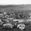
 |
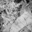
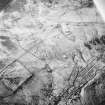
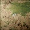
On-line Digital Images |
SC 1693389 |
RCAHMS Aerial Photography |
Oblique aerial view. |
1991 |
Item Level |
|
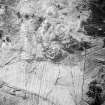 |
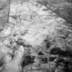
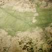
On-line Digital Images |
SC 1693390 |
RCAHMS Aerial Photography |
Oblique aerial view. |
1991 |
Item Level |
|
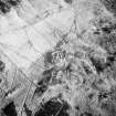 |
On-line Digital Images |
SC 1693392 |
RCAHMS Aerial Photography |
Oblique aerial view. |
1991 |
Item Level |
|
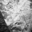 |
On-line Digital Images |
SC 1693393 |
RCAHMS Aerial Photography |
Oblique aerial view. |
1991 |
Item Level |
|
 |
On-line Digital Images |
SC 1693394 |
RCAHMS Aerial Photography |
Oblique aerial view. |
1991 |
Item Level |
|
 |
On-line Digital Images |
SC 1693395 |
RCAHMS Aerial Photography |
Oblique aerial view. |
1991 |
Item Level |
|
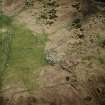 |
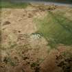
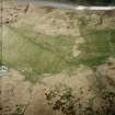
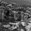
On-line Digital Images |
SC 1693486 |
RCAHMS Aerial Photography |
Oblique aerial view centred on the remains of the dun, settlement and field system with hut-circle and farmstead adjacent, taken from the NE. |
28/4/2004 |
Item Level |
|
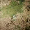 |
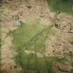
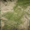
On-line Digital Images |
SC 1693487 |
RCAHMS Aerial Photography |
Oblique aerial view centred on the remains of the dun, settlement and field system with hut-circle and farmstead adjacent, taken from the NW. |
28/4/2004 |
Item Level |
|
 |
On-line Digital Images |
SC 1693488 |
RCAHMS Aerial Photography |
Oblique aerial view centred on the remains of the dun, settlement and field system with hut-circle and farmstead adjacent, taken from the W. |
28/4/2004 |
Item Level |
|
 |
On-line Digital Images |
SC 1693489 |
RCAHMS Aerial Photography |
Oblique aerial view centred on the remains of the farmstead and field system with dun, settlement, hut-circle and burnt mounds adjacent, taken from the W. |
28/4/2004 |
Item Level |
|
 |
On-line Digital Images |
SC 1693490 |
RCAHMS Aerial Photography |
Oblique aerial view centred on the remains of the dun and settlement with field system and hut circle adjacent, taken from the WSW. |
28/4/2004 |
Item Level |
|
 |
On-line Digital Images |
SC 1693491 |
RCAHMS Aerial Photography |
Oblique aerial view centred on the remains of the farmstead and field system with dun, settlement and burnt mounds adjacent, taken from the SSE. |
28/4/2004 |
Item Level |
|
 |
On-line Digital Images |
SC 1693511 |
RCAHMS Aerial Photography |
Oblique aerial view centred on the remains of the dun, settlement and field system with hut-circle and farmstead adjacent, taken from the NNW. |
28/4/2004 |
Item Level |
|
 |
On-line Digital Images |
SC 1693512 |
RCAHMS Aerial Photography |
Oblique aerial view centred on the remains of the dun, settlement and field system with hut-circle and farmstead adjacent, taken from the WNW. |
28/4/2004 |
Item Level |
|
 |
On-line Digital Images |
SC 1693631 |
RCAHMS Aerial Photography |
Oblique aerial view centred on the remains of the farmstead and field system with dun, settlement, hut-circle and burnt mounds adjacent, taken from the W. |
28/4/2004 |
Item Level |
|
 |
On-line Digital Images |
SC 1693632 |
RCAHMS Aerial Photography |
Oblique aerial view centred on the remains of the farmsteads, field system and burnt mounds, taken from the SE. |
28/4/2004 |
Item Level |
|
 |
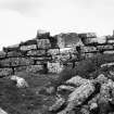
On-line Digital Images |
SC 1924044 |
|
|
1985 |
Item Level |
|
 |
On-line Digital Images |
SC 1924045 |
|
|
1985 |
Item Level |
|
 |
On-line Digital Images |
SC 1924046 |
|
|
1985 |
Item Level |
|
 |
On-line Digital Images |
SC 1924047 |
|
|
1985 |
Item Level |
|
 |
On-line Digital Images |
SC 1924048 |
|
|
1985 |
Item Level |
|
 |
On-line Digital Images |
SC 1924049 |
|
|
1985 |
Item Level |
|
 |
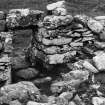
On-line Digital Images |
SC 1925931 |
|
|
1983 |
Item Level |
|
 |
On-line Digital Images |
SC 1925979 |
|
|
1983 |
Item Level |
|


