 |
On-line Digital Images |
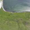
DP 081260 |
RCAHMS Aerial Photography Digital |
Oblique aerial view of the remains of the farmstead at Minn, taken from the W. |
15/6/2010 |
Item Level |
|
 |
On-line Digital Images |
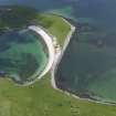
DP 081261 |
RCAHMS Aerial Photography Digital |
Oblique aerial view with the remains of the farmstead at Minn in the foreground, taken from the W. |
15/6/2010 |
Item Level |
|
 |
On-line Digital Images |
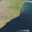
DP 081263 |
RCAHMS Aerial Photography Digital |
General oblique aerial view of Gossiegarth and Minn, taken from the S. |
15/6/2010 |
Item Level |
|
 |
On-line Digital Images |
SC 2337370 |
Records of the Ordnance Survey, Southampton, Hampshire, England |
West Burra, Minn 1, House, HU33SE 44, Ordnance Survey index card, Recto |
c. 1958 |
Item Level |
|
 |
On-line Digital Images |
SC 2337371 |
Records of the Ordnance Survey, Southampton, Hampshire, England |
West Burra, Minn 1, House, HU33SE 44, Ordnance Survey index card, Recto |
c. 1958 |
Item Level |
|