 |
On-line Digital Images |
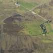
DP 080243 |
RCAHMS Aerial Photography Digital |
Oblique aerial view of the remains of the hut-circles and small cairns at Dremergid, taken from the W. |
29/5/2009 |
Item Level |
|
 |
On-line Digital Images |
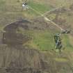
DP 080244 |
RCAHMS Aerial Photography Digital |
Oblique aerial view of the remains of the hut-circles and small cairns at Dremergid, taken from the WSW. |
29/5/2009 |
Item Level |
|
 |
On-line Digital Images |
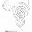
SC 1665112 |
Records of the Royal Commission on the Ancient and Historical Monuments of Scotland (RCAHMS), Edinbu |
Publication drawing; Hut Circle, etc., Dremergid. |
c. 1909 |
Item Level |
|
 |
On-line Digital Images |
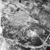
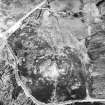
SC 1692941 |
RCAHMS Aerial Photography |
Dremergid, oblique aerial view, taken from the NNE, centred on an area defined as an archaeological landscape, and burnt mounds. Two buildings, a farmstead and hut are visible in the top half of the photograph, and a hut-circle, small cairns and a bank are shown in the bottom left-hand corner. |
13/6/1995 |
Item Level |
|
 |
On-line Digital Images |
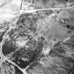
SC 1692942 |
RCAHMS Aerial Photography |
Dremergid, oblique aerial view, taken from the N, centred on an area defined as an archaeological landscape, and burnt mounds. In the upper right-hand corner a building with stack stands and possible clamp-kilns are visible. |
13/6/1995 |
Item Level |
|
 |
On-line Digital Images |
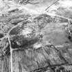
SC 1692943 |
RCAHMS Aerial Photography |
Dremergid, oblique aerial view, taken from the NW, centred on an area defined as an archaeological landscape, and burnt mounds. Hut-circles, small cairns, a bank and a field-system are visible in the top left-hand corner of the photograph. |
13/6/1995 |
Item Level |
|
 |
On-line Digital Images |
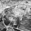
SC 1692944 |
RCAHMS Aerial Photography |
Dremergid, oblique aerial view, taken from the SW, centred on an area defined as an archaeological landscape, and burnt mounds. In the upper right-hand corner an area with a hut-circle, small cairns and a bank is visible, and immediately beside it is another area with a hut-circle and field-system. |
13/6/1995 |
Item Level |
|
 |
On-line Digital Images |
SC 1692945 |
RCAHMS Aerial Photography |
Dremergid, oblique aerial view, taken from the NW, centred on an area defined as an archaeological landscape, and burnt mounds. A building, farmstead and hut are visible in the upper right-hand corner, and hut-circles, small cairns, a bank and a field-system are shown in the top left-hand corner of the photograph. |
13/6/1995 |
Item Level |
|
 |
On-line Digital Images |
SC 1692946 |
RCAHMS Aerial Photography |
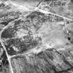
Dremergid, oblique aerial view, taken from the NW, centred on an area defined as an archaeological landscape, burnt mounds and a building. In the upper half of the photograph an area with a hut-circle, small cairns and a bank is visible, and immediately beside it is another area with a hut-circle and field-system. |
13/6/1995 |
Item Level |
|
 |
On-line Digital Images |
SC 1692947 |
RCAHMS Aerial Photography |
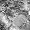
Dremergid, oblique aerial view, taken from the SW, centred on an area defined as an archaeological landscape, and burnt mounds. A hut-circle, small cairns and a bank is visible in the top right-hand corner, and the remains of a building is shown in the bottom right-hand corner of the photograph. |
13/6/1995 |
Item Level |
|
 |
On-line Digital Images |
SC 1692948 |
RCAHMS Aerial Photography |
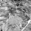
Dremergid, oblique aerial view, taken from the SW, centred on an area defined as an archaeological landscape, burnt mounds and an area with a hut-circle, small cairns and a bank. The remains of a building is visible in the bottom left-hand corner of the photograph. |
13/6/1995 |
Item Level |
|
 |
On-line Digital Images |
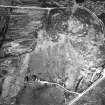
SC 1692979 |
RCAHMS Aerial Photography |
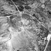
Dremergid, oblique aerial view, taken from the SSW, centred on an area defined as an archaeological landscape, and burnt mound. A hut-circle, small cairns and a bank are visible in the upper right-hand corner of the photograph. |
23/6/1995 |
Item Level |
|
 |
On-line Digital Images |
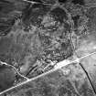
SC 1692980 |
RCAHMS Aerial Photography |
Dremergid, oblique aerial view, taken from the SE, centred on an area defined as an archaeological landscape, and burnt mound. The remains of a building is visible in the bottom left-hand corner of the photograph. |
23/6/1995 |
Item Level |
|
 |
On-line Digital Images |
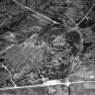
SC 1692981 |
RCAHMS Aerial Photography |
Dremergid, oblique aerial view, taken from the SE, centred on an area defined as an archaeological landscape, and burnt mound. A hut-circle, small cairns and a bank, and a field-system, a hut-circle and a possible hut is visible in the right-hand side of the photograph. |
23/6/1995 |
Item Level |
|
 |
On-line Digital Images |
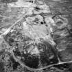
SC 1692982 |
RCAHMS Aerial Photography |
Dremergid, oblique aerial view, taken from the SE, centred on an area defined as an archaeological landscape, and burnt mound. A hut-circle, small cairns and a bank is visible in the bottom right-hand side of the photograph. |
23/6/1995 |
Item Level |
|
 |
On-line Digital Images |
SC 1692983 |
RCAHMS Aerial Photography |
Dremergid, oblique aerial view, taken from the NW, centred on an area defined as an archaeological landscape, and burnt mound. A building and a farmstead is visible in the centre and top half of the photograph. |
23/6/1995 |
Item Level |
|
 |
On-line Digital Images |
SC 1692984 |
RCAHMS Aerial Photography |
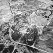
Dremergid, oblique aerial view, taken from the NW, centred on an area defined as an archaeological landscape, and burnt mound. A building and a farmstead is visible in the top right-hand corner of the photograph, and a hut-circle, bank and small cairns, as well as a fieldsystem, hut and hut-circle is shown in the top left-hand corner area.. |
23/6/1995 |
Item Level |
|
 |
On-line Digital Images |
SC 1692985 |
RCAHMS Aerial Photography |
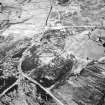
Dremergid, oblique aerial view, taken from the NW, centred on an area defined as an archaeological landscape, and burnt mound. A hut-circle, bank and small cairns, as well as a fieldsystem, hut and hut-circle is visible in the top left-hand corner area of the photograph. |
23/6/1995 |
Item Level |
|
 |
On-line Digital Images |
SC 1944837 |
Papers of James Sloan Bone, landscape historian, Inverness, Highland, Scotland |
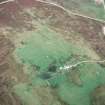
Aerial view of settlement site at Dremergid, Rogart, Sutherland, looking NE. |
28/1/1998 |
Item Level |
|
 |
On-line Digital Images |
SC 2348499 |
Records of the Ordnance Survey, Southampton, Hampshire, England |
Dremergid, NC70NW 18, Ordnance Survey index card, page number 2, Verso |
c. 1958 |
Item Level |
|
 |
On-line Digital Images |
SC 2348500 |
Records of the Ordnance Survey, Southampton, Hampshire, England |
Dremergid, NC70NW 18, Ordnance Survey index card, page number 3, Recto |
c. 1958 |
Item Level |
|
 |
On-line Digital Images |
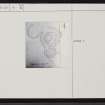
SC 2348501 |
Records of the Ordnance Survey, Southampton, Hampshire, England |
Dremergid, NC70NW 18, Ordnance Survey index card, Recto |
c. 1958 |
Item Level |
|
 |
On-line Digital Images |
SC 2348502 |
Records of the Ordnance Survey, Southampton, Hampshire, England |
Dremergid, NC70NW 18, Ordnance Survey index card, Recto |
c. 1958 |
Item Level |
|