 |
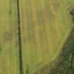
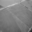
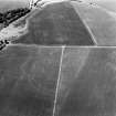
On-line Digital Images |
DP 079313 |
RCAHMS Aerial Photography Digital |
Oblique aerial view of the cropmarks of the possible pits, taken from the WNW. |
16/7/2009 |
Item Level |
|
 |
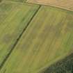
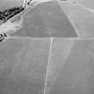
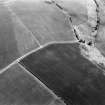
On-line Digital Images |
DP 079314 |
RCAHMS Aerial Photography Digital |
Oblique aerial view of the cropmarks of the possible pits, taken from the SW. |
16/7/2009 |
Item Level |
|
 |
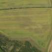
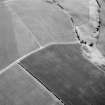
On-line Digital Images |
DP 079315 |
RCAHMS Aerial Photography Digital |
Oblique aerial view of the cropmarks of the possible pits, taken from the SSW. |
16/7/2009 |
Item Level |
|
 |
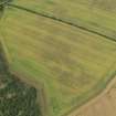
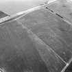
On-line Digital Images |
DP 079316 |
RCAHMS Aerial Photography Digital |
Oblique aerial view of the cropmarks of the possible pits, taken from the SSE. |
16/7/2009 |
Item Level |
|
 |
On-line Digital Images |
DP 079317 |
RCAHMS Aerial Photography Digital |
Oblique aerial view of the cropmarks of the possible pits, taken from the SE. |
16/7/2009 |
Item Level |
|
 |
On-line Digital Images |
SC 1221592 |
RCAHMS Aerial Photography |
Oblique aerial view. |
1980 |
Item Level |
|
 |
On-line Digital Images |
SC 1221593 |
RCAHMS Aerial Photography |
Oblique aerial view. |
1980 |
Item Level |
|
 |
On-line Digital Images |
SC 1221599 |
RCAHMS Aerial Photography |
Oblique aerial view. |
1980 |
Item Level |
|
 |
On-line Digital Images |
SC 1745560 |
RCAHMS Aerial Photography |
Oblique aerial view. |
1980 |
Item Level |
|
 |
On-line Digital Images |
SC 1745561 |
RCAHMS Aerial Photography |
Oblique aerial view. |
1980 |
Item Level |
|
 |
On-line Digital Images |
SC 1745562 |
RCAHMS Aerial Photography |
Oblique aerial view. |
1980 |
Item Level |
|
 |
On-line Digital Images |
SC 2451139 |
Records of the Ordnance Survey, Southampton, Hampshire, England |
Whitelaw Hill, NT57SE 59, Ordnance Survey index card, Recto |
c. 1958 |
Item Level |
|


