 |
On-line Digital Images |
DP 095550 |
RCAHMS Aerial Photography Digital |
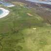
General oblique aerial view of the field system on Druim Mor, taken from the SE. |
1/9/2010 |
Item Level |
|
 |
On-line Digital Images |
DP 095551 |
RCAHMS Aerial Photography Digital |
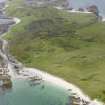
Oblique aerial view of shell middens lying in the dunes above Traigh Uamha Seilbhe, looking towards the field system on Druim Mor, taken from the NE. |
1/9/2010 |
Item Level |
|
 |
On-line Digital Images |
SC 2414474 |
Records of the Ordnance Survey, Southampton, Hampshire, England |
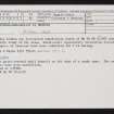
Oronsay, 'Caisteal Nan Gillean 2', NR38NE 15, Ordnance Survey index card, Recto |
c. 1958 |
Item Level |
|
 |
On-line Digital Images |
SC 2414475 |
Records of the Ordnance Survey, Southampton, Hampshire, England |
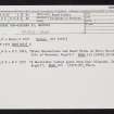
Oronsay, 'Caisteal Nan Gillean 2', NR38NE 15, Ordnance Survey index card, Recto |
c. 1958 |
Item Level |
|


