 |
On-line Digital Images |
DP 228130 |
Records of the Royal Commission on the Ancient and Historical Monuments of Scotland (RCAHMS), Edinbu |
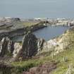
Quarry NM71NW 117 (An Lub Chlear), general view from hill to east |
7/9/2015 |
Item Level |
|
 |
On-line Digital Images |
DP 228132 |
Records of the Royal Commission on the Ancient and Historical Monuments of Scotland (RCAHMS), Edinbu |
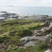
Quarries NM71NW 117, 118 and 119.01 (An Lub Chlear, Fang and and Rudbha Nam Faoileann), and Klondye (NM71NW 120, foreground), view from hill to east |
7/9/2015 |
Item Level |
|
 |
On-line Digital Images |
DP 228133 |
Records of the Royal Commission on the Ancient and Historical Monuments of Scotland (RCAHMS), Edinbu |
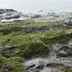
Quarry NM71NW 118 (An Lub Chlear) and track, view from hill to east. Quarry NM71NW 120, 'Klondyke', right foreground |
7/9/2015 |
Item Level |
|
 |
On-line Digital Images |
DP 228135 |
Records of the Royal Commission on the Ancient and Historical Monuments of Scotland (RCAHMS), Edinbu |
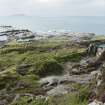
Quarries NM71NW 117 and 118 and 119 (An Lub Chlear, Fang and Rudbha Nam Faoileann/An Staca Dubh) and tramway track, spoil from the south west quarries and walls from view from hill to east |
7/9/2015 |
Item Level |
|
 |
On-line Digital Images |
DP 228156 |
Records of the Royal Commission on the Ancient and Historical Monuments of Scotland (RCAHMS), Edinbu |
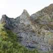
Quarried area to south east of NM71NW 120, known as the 'Klondyke', view from south east |
7/9/2015 |
Item Level |
|
 |
On-line Digital Images |
DP 228157 |
Records of the Royal Commission on the Ancient and Historical Monuments of Scotland (RCAHMS), Edinbu |
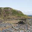
Enclosure to south of quarry NM71NW 117 (An Lub Chlear), view from north west |
7/9/2015 |
Item Level |
|
 |
On-line Digital Images |
DP 228167 |
Records of the Royal Commission on the Ancient and Historical Monuments of Scotland (RCAHMS), Edinbu |
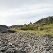
Remains of garden enclosures around NM73627 16999 to south east of quarry NM71NW 117, view from south east. Tramway embankment also visible (NM73604 17002) |
7/9/2015 |
Item Level |
|
 |
On-line Digital Images |
DP 228170 |
Records of the Royal Commission on the Ancient and Historical Monuments of Scotland (RCAHMS), Edinbu |
Hill, view from south west |
7/9/2015 |
Item Level |
|
 |
On-line Digital Images |
DP 228229 |
Records of the Royal Commission on the Ancient and Historical Monuments of Scotland (RCAHMS), Edinbu |
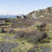
Quarries NM71NW 117, NM71NW 118 (both flooded) and NM71NW120, west track and enclosure, view from high ground to east |
7/9/2015 |
Item Level |
|
 |
On-line Digital Images |
DP 232627 |
Historic Environment Scotland |
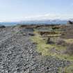
South garden enclosures and track, general view from south east at NM73639 16991 south east of NM71NW 120 (quarry) |
21/3/2016 |
Item Level |
|
 |
On-line Digital Images |
DP 232628 |
Historic Environment Scotland |
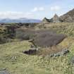
Shoreline, track and south garden enclosures, general view from east at NM73639 16991 |
21/3/2016 |
Item Level |
|
 |
On-line Digital Images |
DP 232633 |
Historic Environment Scotland |
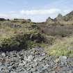
South garden enclosures around NM73630 17002, view from south |
21/3/2016 |
Item Level |
|
 |
On-line Digital Images |
DP 232635 |
Historic Environment Scotland |
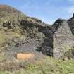
Garden enclosure enclosure to east of quarry NM71NW 118, view from south east with NM71NW 120, Klondyke Quarry in the background |
21/3/2016 |
Item Level |
|
 |
On-line Digital Images |
DP 232637 |
Historic Environment Scotland |
Boiler house, view from west. The Klondyke Quarry (NM71NW 120/ Canmore ID: 353998) sits behind it. |
21/3/2016 |
Item Level |
|
 |
On-line Digital Images |
DP 232638 |
Historic Environment Scotland |
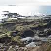
West end of island, general view from high ground to east |
21/3/2016 |
Item Level |
|
 |
On-line Digital Images |
DP 232644 |
Historic Environment Scotland |
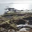
General view of west end of island from high ground to north east |
21/3/2016 |
Item Level |
|
 |
On-line Digital Images |
DP 232669 |
Historic Environment Scotland |
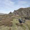
Track to east of quarry (NM71NW 120), view from south with quarry to the right |
21/3/2016 |
Item Level |
|
 |
On-line Digital Images |
DP 232670 |
Historic Environment Scotland |
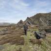
Track to east of quarry (NM71NW 120), view from south with quarry on the right |
21/3/2016 |
Item Level |
|
 |
On-line Digital Images |
DP 232671 |
Historic Environment Scotland |
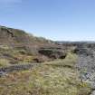
South garden enclosures and track, view from west at NM73591 17005 |
21/3/2016 |
Item Level |
|
 |
On-line Digital Images |
DP 232672 |
Historic Environment Scotland |
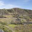
Garden enclosures around NM7356 1706, to north east of quarry (NM71NW 118.00), view from south. Quarry NM71NW 120 in background |
21/3/2016 |
Item Level |
|
 |
On-line Digital Images |
DP 232673 |
Historic Environment Scotland |
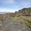
Track to south east of quarry NM71NW 117, view from south with quarry NM71NW 120 on the right |
21/3/2016 |
Item Level |
|
 |
On-line Digital Images |
DP 232683 |
Historic Environment Scotland |
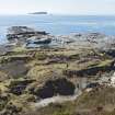
Quarry (NM71NW 118.00) and south garden enclosures around NM73560 17070, view from high ground to north east |
21/3/2016 |
Item Level |
|
 |
On-line Digital Images |
DP 232686 |
Historic Environment Scotland |
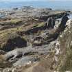
South garden enclosures to north east of quarry no.7 (NM71NW 118), and enclosures at NM75573 17057 and NM73559 17074, view from high ground to east. Part of NM71NW 120 can also be seen in right of image |
21/3/2016 |
Item Level |
|
 |
On-line Digital Images |
DP 232687 |
Historic Environment Scotland |
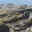
South garden enclosures to north east of quarry no.7 (NM71NW 118), and enclosures at NM75573 17057 and NM73559 17074, view from high ground to east. Part of NM71NW 120 can also be seen in right of image with some of its working areas identifiable at the lower level. |
21/3/2016 |
Item Level |
|