 |
On-line Digital Images |
SC 1716232 |
RCAHMS Aerial Photography |
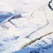
Oblique aerial view of Castle Hill centred on the remains of a ring-ditch house with a fort and mound adjacent, taken from the N. |
26/1/1999 |
Item Level |
|
 |
On-line Digital Images |
SC 1716233 |
RCAHMS Aerial Photography |
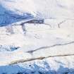
Oblique aerial view of Castle Hill centred on the remains of a ring-ditch house with a fort and mound adjacent, taken from the NW. |
26/1/1999 |
Item Level |
|
 |
On-line Digital Images |
SC 1716234 |
RCAHMS Aerial Photography |
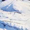
Oblique aerial view of Castle Hill centred on the remains of a ring-ditch house with a fort, mound and rig adjacent, taken from the NW. |
26/1/1999 |
Item Level |
|
 |
On-line Digital Images |
SC 2404160 |
Records of the Ordnance Survey, Southampton, Hampshire, England |
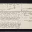
Castle Hill, Meams, NO35NE 6, Ordnance Survey index card, page number 1, Recto |
c. 1958 |
Item Level |
|
 |
On-line Digital Images |
SC 2404161 |
Records of the Ordnance Survey, Southampton, Hampshire, England |
Castle Hill, Meams, NO35NE 6, Ordnance Survey index card, page number 2, Verso |
c. 1958 |
Item Level |
|
 |
On-line Digital Images |
SC 2404162 |
Records of the Ordnance Survey, Southampton, Hampshire, England |
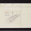
Castle Hill, Meams, NO35NE 6, Ordnance Survey index card, Recto |
c. 1958 |
Item Level |
|
 |
On-line Digital Images |
SC 2404163 |
Records of the Ordnance Survey, Southampton, Hampshire, England |
Castle Hill, Meams, NO35NE 6, Ordnance Survey index card, Recto |
c. 1958 |
Item Level |
|
 |
On-line Digital Images |
SC 2404164 |
Records of the Ordnance Survey, Southampton, Hampshire, England |
Castle Hill, Meams, NO35NE 6, Ordnance Survey index card, Recto |
c. 1958 |
Item Level |
|


