 |
On-line Digital Images |
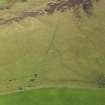
DP 097114 |
RCAHMS Aerial Photography Digital |
General oblique aerial view of Strone Hill, centred on the remains of the field system and township, taken from the SW. |
30/9/2010 |
Item Level |
|
 |
On-line Digital Images |
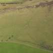
DP 097115 |
RCAHMS Aerial Photography Digital |
General oblique aerial view of Strone Hill, centred on the remains of the field system and township taken from the SSW. |
30/9/2010 |
Item Level |
|
 |
On-line Digital Images |
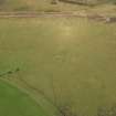
DP 097116 |
RCAHMS Aerial Photography Digital |
General oblique aerial view of Strone Hill, centred on the remains of the field system and township, taken from the S. |
30/9/2010 |
Item Level |
|
 |
On-line Digital Images |
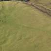
DP 097117 |
RCAHMS Aerial Photography Digital |
General oblique aerial view of Strone Hill, centred on the remains of the field system and township, taken from the SE. |
30/9/2010 |
Item Level |
|
 |
On-line Digital Images |
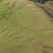
DP 097118 |
RCAHMS Aerial Photography Digital |
General oblique aerial view of Strone Hill, centred on the remains of the field system and township, taken from the ENE. |
30/9/2010 |
Item Level |
|
 |
On-line Digital Images |
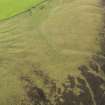
DP 097119 |
RCAHMS Aerial Photography Digital |
General oblique aerial view of Strone Hill, centred on the remains of the field system and township, taken from the NE. |
30/9/2010 |
Item Level |
|
 |
On-line Digital Images |
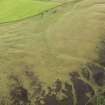
DP 097120 |
RCAHMS Aerial Photography Digital |
General oblique aerial view of Strone Hill, centred on the remains of the field system and township, taken from the NNE. |
30/9/2010 |
Item Level |
|
 |
On-line Digital Images |
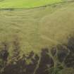
DP 097121 |
RCAHMS Aerial Photography Digital |
General oblique aerial view of Strone Hill, centred on the remains of the field system and township, taken from the NNE. |
30/9/2010 |
Item Level |
|
 |
On-line Digital Images |
DP 097122 |
RCAHMS Aerial Photography Digital |
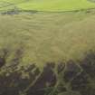
General oblique aerial view of Strone Hill, centred on the remains of the field system and township, taken from the N. |
30/9/2010 |
Item Level |
|
 |
On-line Digital Images |
DP 097123 |
RCAHMS Aerial Photography Digital |
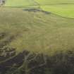
General oblique aerial view of Strone Hill, centred on the remains of the field system and township, taken from the N. |
30/9/2010 |
Item Level |
|
 |
On-line Digital Images |
DP 097124 |
RCAHMS Aerial Photography Digital |
General oblique aerial view of Strone Hill, centred on the remains of the field system and township, taken from the NNW. |
30/9/2010 |
Item Level |
|
 |
On-line Digital Images |
DP 097125 |
RCAHMS Aerial Photography Digital |
General oblique aerial view of Strone Hill, centred on the remains of the field system and township, taken from the NW. |
30/9/2010 |
Item Level |
|
 |
On-line Digital Images |
DP 097126 |
RCAHMS Aerial Photography Digital |
General oblique aerial view of Strone Hill, centred on the remains of the field system and township, taken from the WNW. |
30/9/2010 |
Item Level |
|
 |
On-line Digital Images |
DP 228885 |
Historic Environment Scotland |
Oblique aerial view of the township, field system, hut circles, ring cairns and cairnfield on Strone Hill, looking SW. |
15/1/2016 |
Item Level |
|
 |
On-line Digital Images |
DP 228886 |
Historic Environment Scotland |
Oblique aerial view of the township, field system, hut circles, ring cairns and cairnfield on Strone Hill, looking SW. |
15/1/2016 |
Item Level |
|
 |
On-line Digital Images |
DP 228888 |
Historic Environment Scotland |
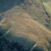
Oblique aerial view of the township, field system, hut circles, ring cairns and cairnfield on Strone Hill, looking SE. |
15/1/2016 |
Item Level |
|
 |
On-line Digital Images |
DP 228887 |
Historic Environment Scotland |
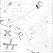
Oblique aerial view of the township, field system, hut circles, ring cairns and cairnfield on Strone Hill, looking SE. |
15/1/2016 |
Item Level |
|
 |
On-line Digital Images |
SC 2088362 |
Records of the Royal Commission on the Ancient and Historical Monuments of Scotland (RCAHMS), Edinbu |
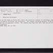
Plan of Strone Hill complex |
8/6/1998 |
Item Level |
|
 |
On-line Digital Images |
SC 2402056 |
Records of the Ordnance Survey, Southampton, Hampshire, England |
Strone Hill, NO25NE 18, Ordnance Survey index card, Recto |
c. 1958 |
Item Level |
|
 |
On-line Digital Images |
SC 2402057 |
Records of the Ordnance Survey, Southampton, Hampshire, England |
Strone Hill, NO25NE 18, Ordnance Survey index card, Recto |
c. 1958 |
Item Level |
|
 |
On-line Digital Images |
SC 2402058 |
Records of the Ordnance Survey, Southampton, Hampshire, England |
Strone Hill, NO25NE 18, Ordnance Survey index card, page number 1, Recto |
c. 1958 |
Item Level |
|
 |
On-line Digital Images |
SC 2402059 |
Records of the Ordnance Survey, Southampton, Hampshire, England |
Strone Hill, NO25NE 18, Ordnance Survey index card, page number 2, Recto |
c. 1958 |
Item Level |
|
 |
On-line Digital Images |
SC 2402060 |
Records of the Ordnance Survey, Southampton, Hampshire, England |
Strone Hill, NO25NE 18, Ordnance Survey index card, page number 3, Recto |
c. 1958 |
Item Level |
|


