 |
On-line Digital Images |
SC 385364 |
|
RCAHMSAP 83(see also NO15NE 12) |
|
Item Level |
|
 |
On-line Digital Images |
SC 1710643 |
RCAHMS Aerial Photography |
RCAHMSAP 83(see also NO15NE 12) |
|
Item Level |
|
 |
On-line Digital Images |
SC 1710644 |
RCAHMS Aerial Photography |
RCAHMSAP 83(see also NO15NE 12) |
|
Item Level |
|
 |
On-line Digital Images |
SC 1710645 |
RCAHMS Aerial Photography |
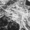
Oblique aerial view. |
1983 |
Item Level |
|
 |
On-line Digital Images |
SC 1710936 |
RCAHMS Aerial Photography |
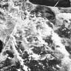
Oblique aerial view. |
1983 |
Item Level |
|
 |
On-line Digital Images |
SC 1710937 |
RCAHMS Aerial Photography |
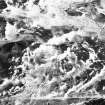
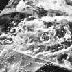
Oblique aerial view. |
1983 |
Item Level |
|
 |
On-line Digital Images |
SC 2191533 |
Records of the Royal Commission on the Ancient and Historical Monuments of Scotland (RCAHMS), Edinbu |
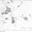
Overlay plan. NE Perth Inv 124.4c. IP/JRS |
27/11/1987 |
Item Level |
|
 |
On-line Digital Images |
SC 2191539 |
Records of the Royal Commission on the Ancient and Historical Monuments of Scotland (RCAHMS), Edinbu |
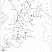
Overlay and base map showing distribution of sites in Drumturn Burn area. NE Perth Inv 124. |
|
Item Level |
|
 |
On-line Digital Images |
SC 2398790 |
Records of the Ordnance Survey, Southampton, Hampshire, England |
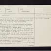
Knockali, NO15NW 13, Ordnance Survey index card, page number 1, Recto |
1958 |
Item Level |
|
 |
On-line Digital Images |
SC 2398791 |
Records of the Ordnance Survey, Southampton, Hampshire, England |
Knockali, NO15NW 13, Ordnance Survey index card, Recto |
1958 |
Item Level |
|
 |
On-line Digital Images |
SC 2398792 |
Records of the Ordnance Survey, Southampton, Hampshire, England |
Knockali, NO15NW 13, Ordnance Survey index card, page number 2, Verso |
1958 |
Item Level |
|


