 |
On-line Digital Images |
SC 397568 |
RCAHMS Aerial Photography |
Oblique aerial view. |
1988 |
Item Level |
|
 |
On-line Digital Images |
SC 505319 |
|
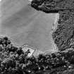
Cambusmichael, oblique aerial view, taken from the NE, centred on the cropmarks of the Grange. Cambusmichael Church is visible in the foreground. |
|
Item Level |
|
 |
On-line Digital Images |
SC 816254 |
RCAHMS Aerial Photography |
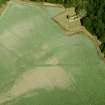
Digital image of Cambusmichael, oblique aerial view, taken from the SSW, centred on the cropmarks of the Grange. Cambusmichael Church is visible in the top half of the photograph. |
28/8/1995 |
Item Level |
|
 |
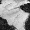
On-line Digital Images |
SC 1709669 |
RCAHMS Aerial Photography |
Oblique aerial view. |
1988 |
Item Level |
|
 |
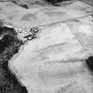
On-line Digital Images |
SC 1709670 |
RCAHMS Aerial Photography |
Oblique aerial view. |
1988 |
Item Level |
|
 |
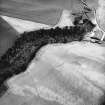
On-line Digital Images |
SC 1709671 |
RCAHMS Aerial Photography |
Oblique aerial view. |
1988 |
Item Level |
|
 |
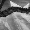
On-line Digital Images |
SC 1709672 |
RCAHMS Aerial Photography |
Oblique aerial view. |
1988 |
Item Level |
|
 |
On-line Digital Images |
SC 1709673 |
RCAHMS Aerial Photography |
Oblique aerial view. |
1988 |
Item Level |
|
 |
On-line Digital Images |
SC 1709674 |
RCAHMS Aerial Photography |
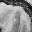
Oblique aerial view. |
1988 |
Item Level |
|
 |
On-line Digital Images |
SC 1709705 |
RCAHMS Aerial Photography |
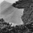
Cambusmichael, oblique aerial view, taken from the NE, centred on the cropmarks of the Grange. Cambusmichael Church is visible in the foreground. |
28/8/1995 |
Item Level |
|
 |
On-line Digital Images |
SC 1709706 |
RCAHMS Aerial Photography |
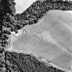
Cambusmichael, oblique aerial view, taken from the WNW, centred on the cropmarks of the Grange. Cambusmichael Church is visible in the centre left of the photograph. |
28/8/1995 |
Item Level |
|
 |
On-line Digital Images |
SC 1709707 |
RCAHMS Aerial Photography |
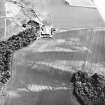
Cambusmichael, oblique aerial view taken from the NW, centred on the cropmarks of two seperate enclosures, settlement traces and a grange. |
16/7/1996 |
Item Level |
|
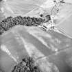 |
On-line Digital Images |
SC 1709708 |
RCAHMS Aerial Photography |
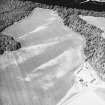
Cambusmichael, oblique aerial view taken from the W, centred on the cropmarks of two seperate enclosures, settlement traces and a grange. |
16/7/1996 |
Item Level |
|
 |
On-line Digital Images |
SC 1709709 |
RCAHMS Aerial Photography |
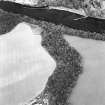
Cambusmichael, oblique aerial view taken from the S, centred on the cropmarks of two seperate enclosures, settlement traces and a grange. |
16/7/1996 |
Item Level |
|
 |
On-line Digital Images |
SC 1709738 |
RCAHMS Aerial Photography |
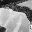
Oblique aerial view centred on the cropmarks of the enclosure and grange with the ruins of the burial ground and church adjacent, taken from the S. |
14/8/2000 |
Item Level |
|
 |
On-line Digital Images |
SC 1709739 |
RCAHMS Aerial Photography |
Oblique aerial view centred on the cropmarks of the enclosure and grange with the ruins of the burial ground and church adjacent, taken from the SW. |
14/8/2000 |
Item Level |
|
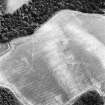 |
On-line Digital Images |
SC 1709740 |
RCAHMS Aerial Photography |
Oblique aerial view centred on the cropmarks of the enclosure and grange, taken from the W. |
14/8/2000 |
Item Level |
|
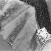 |
On-line Digital Images |
SC 1709773 |
RCAHMS Aerial Photography |
Oblique aerial view. |
1977 |
Item Level |
|
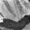 |
On-line Digital Images |
SC 1709774 |
RCAHMS Aerial Photography |
Oblique aerial view. |
1977 |
Item Level |
|
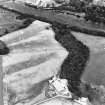 |
On-line Digital Images |
SC 1709775 |
RCAHMS Aerial Photography |
Oblique aerial view. |
1977 |
Item Level |
|
 |
On-line Digital Images |
SC 2397944 |
Records of the Ordnance Survey, Southampton, Hampshire, England |
Cambusmichael, NO13SW 30, Ordnance Survey index card, Recto |
c. 1958 |
Item Level |
|
 |
On-line Digital Images |
SC 2397945 |
Records of the Ordnance Survey, Southampton, Hampshire, England |
Cambusmichael, NO13SW 30, Ordnance Survey index card, Recto |
c. 1958 |
Item Level |
|
 |
On-line Digital Images |
SC 2397946 |
Records of the Ordnance Survey, Southampton, Hampshire, England |
Cambusmichael, NO13SW 30, Ordnance Survey index card, Recto |
c. 1958 |
Item Level |
|


