 |
On-line Digital Images |
SC 505319 |
|
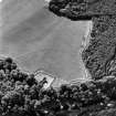
Cambusmichael, oblique aerial view, taken from the NE, centred on the cropmarks of the Grange. Cambusmichael Church is visible in the foreground. |
|
Item Level |
|
 |
On-line Digital Images |
SC 816254 |
RCAHMS Aerial Photography |
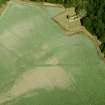
Digital image of Cambusmichael, oblique aerial view, taken from the SSW, centred on the cropmarks of the Grange. Cambusmichael Church is visible in the top half of the photograph. |
28/8/1995 |
Item Level |
|
 |
On-line Digital Images |
SC 1322679 |
General Collection. Glass Lantern Slides |
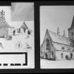
photographic copy of drawing. |
|
Item Level |
|
 |
On-line Digital Images |
SC 1568396 |
Papers of Betty Willsher, historian, St Andrews, Scotland |
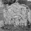
View of gravestone for Patrick Davidson dated 1786, in the churchyard of Cambusmichael Church. |
1986 |
Item Level |
|
 |
On-line Digital Images |
SC 1568397 |
Papers of Betty Willsher, historian, St Andrews, Scotland |
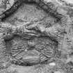
Detail of gravestone for Margaret Scott dated 1748, in the churchyard of Cambusmichael Church. |
1986 |
Item Level |
|
 |
On-line Digital Images |
SC 1568398 |
Papers of Betty Willsher, historian, St Andrews, Scotland |
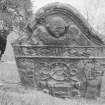
Detail of gravestone for John Miller, 1783, in the churchyard of Cambusmichael church. |
1986 |
Item Level |
|
 |
On-line Digital Images |
SC 1709705 |
RCAHMS Aerial Photography |
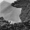
Cambusmichael, oblique aerial view, taken from the NE, centred on the cropmarks of the Grange. Cambusmichael Church is visible in the foreground. |
28/8/1995 |
Item Level |
|
 |
On-line Digital Images |
SC 1709706 |
RCAHMS Aerial Photography |
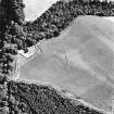
Cambusmichael, oblique aerial view, taken from the WNW, centred on the cropmarks of the Grange. Cambusmichael Church is visible in the centre left of the photograph. |
28/8/1995 |
Item Level |
|
 |
On-line Digital Images |
SC 1709709 |
RCAHMS Aerial Photography |
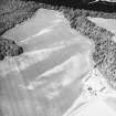
Cambusmichael, oblique aerial view taken from the S, centred on the cropmarks of two seperate enclosures, settlement traces and a grange. |
16/7/1996 |
Item Level |
|
 |
On-line Digital Images |
SC 1709738 |
RCAHMS Aerial Photography |
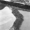
Oblique aerial view centred on the cropmarks of the enclosure and grange with the ruins of the burial ground and church adjacent, taken from the S. |
14/8/2000 |
Item Level |
|
 |
On-line Digital Images |
SC 1709739 |
RCAHMS Aerial Photography |
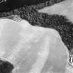
Oblique aerial view centred on the cropmarks of the enclosure and grange with the ruins of the burial ground and church adjacent, taken from the SW. |
14/8/2000 |
Item Level |
|
 |
On-line Digital Images |
SC 2213719 |
Records of the Royal Commission on the Ancient and Historical Monuments of Scotland (RCAHMS), Edinbu |
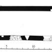
Publication plan; Cambusmichael, church |
1989 |
Item Level |
|
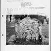 |
On-line Digital Images |
SC 2227439 |
Papers of Betty Willsher, historian, St Andrews, Scotland |
Photographs and research notes relating to graveyard monuments in Cambusmichael (St Martin's) Churchyard, Perthshire. |
|
Item Level |
|
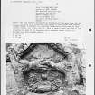 |
On-line Digital Images |
SC 2227440 |
Papers of Betty Willsher, historian, St Andrews, Scotland |
Photographs and research notes relating to graveyard monuments in Cambusmichael Old Churchyard, Perthshire. |
|
Item Level |
|
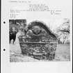 |
On-line Digital Images |
SC 2227441 |
Papers of Betty Willsher, historian, St Andrews, Scotland |
Photographs and research notes relating to graveyard monuments in Cambusmichael Old Churchyard, Perthshire. |
|
Item Level |
|
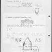 |
On-line Digital Images |
SC 2227442 |
Papers of Betty Willsher, historian, St Andrews, Scotland |
Photographs and research notes relating to graveyard monuments in Cambusmichael Churchyard, Perthshire. |
|
Item Level |
|
 |
On-line Digital Images |
SC 2397904 |
Records of the Ordnance Survey, Southampton, Hampshire, England |
Stanley, Cambusmichael Church And Burial-Ground, NO13SW 17, Ordnance Survey index card, Recto |
c. 1958 |
Item Level |
|
 |
On-line Digital Images |
SC 2397905 |
Records of the Ordnance Survey, Southampton, Hampshire, England |
Stanley, Cambusmichael Church And Burial-Ground, NO13SW 17, Ordnance Survey index card, Recto |
c. 1958 |
Item Level |
|
 |
On-line Digital Images |
SC 2397906 |
Records of the Ordnance Survey, Southampton, Hampshire, England |
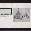
Stanley, Cambusmichael Church And Burial-Ground, NO13SW 17, Ordnance Survey index card, Recto |
c. 1958 |
Item Level |
|
 |
On-line Digital Images |
SC 2397907 |
Records of the Ordnance Survey, Southampton, Hampshire, England |
Stanley, Cambusmichael Church And Burial-Ground, NO13SW 17, Ordnance Survey index card, Recto |
c. 1958 |
Item Level |
|
 |
On-line Digital Images |
SC 2635090 |
|
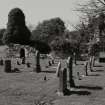
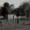
General view of church, from SSE. |
1989 |
Item Level |
|
 |
On-line Digital Images |
SC 2635091 |
|
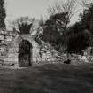
General view of church, from SW. |
1989 |
Item Level |
|
 |
On-line Digital Images |
SC 2635092 |
|
Exterior view of S wall of church, showing doorway at W end. |
1989 |
Item Level |
|
 |
On-line Digital Images |
SC 2635093 |
|
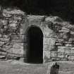
Exterior view of doorway at W end of S wall. |
1989 |
Item Level |
|


