 |
On-line Digital Images |
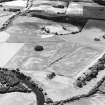
SC 1709510 |
RCAHMS Aerial Photography |
Oblique aerial view centred on the cropmarks of an enclosure and trackways with round house, enclosure, pits, cultivation remains, pit-alignment and long barrow adjacent, taken from the NE. |
6/7/1998 |
Item Level |
|
 |
On-line Digital Images |
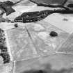
SC 1709511 |
RCAHMS Aerial Photography |
Oblique aerial view centred on the cropmarks of an enclosure and trackways with round house, enclosure, pits, cultivation remains, pit-alignment long barrow, square barrow and plantation bank adjacent, taken from the NW. |
6/7/1998 |
Item Level |
|
 |
On-line Digital Images |
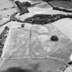
SC 1709512 |
RCAHMS Aerial Photography |
Oblique aerial view centred on the cropmarks of an enclosure and trackways with round house, enclosure, pits, cultivation remains, pit-alignment and long barrow adjacent, taken from the WNW. |
6/7/1998 |
Item Level |
|
 |
On-line Digital Images |
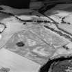
SC 1859801 |
RCAHMS Aerial Photography |
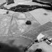
Oblique aerial view centred on the cropmarks of an enclosure and trackways with round house, enclosure, pits, cultivation remains, pit-alignment and long barrow adjacent, taken from the SE. |
6/7/1998 |
Item Level |
|
 |
On-line Digital Images |
SC 1859802 |
RCAHMS Aerial Photography |
Oblique aerial view centred on the cropmarks of an enclosure and trackways with round house, enclosure, pits, cultivation remains, pit-alignment long barrow, square barrow and plantation bank adjacent, taken from the WNW. |
6/7/1998 |
Item Level |
|
 |
On-line Digital Images |
SC 2397621 |
Records of the Ordnance Survey, Southampton, Hampshire, England |
Herald Hill, NO13NE 62, Ordnance Survey index card, Recto |
c. 1958 |
Item Level |
|


