 |
On-line Digital Images |
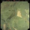
SC 947709 |
Scottish Development Department: Commissioned Aerial Imagery |
Vertical aerial view showing the course of The Waverley Line including Stow station. |
14/5/1992 |
Item Level |
|
 |
On-line Digital Images |
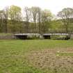
DP 058130 |
RCAHMS Field Survey Digital Photography |
General view from W of railway bridge no.70, Lugate Water |
23/4/2009 |
Item Level |
|
 |
On-line Digital Images |
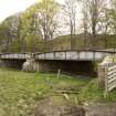
DP 058131 |
RCAHMS Field Survey Digital Photography |
View from SSW. |
23/4/2009 |
Item Level |
|
 |
On-line Digital Images |
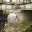
DP 058132 |
RCAHMS Field Survey Digital Photography |
Detail of bridge pier and cutwater. |
23/4/2009 |
Item Level |
|
 |
On-line Digital Images |
DP 058133 |
RCAHMS Field Survey Digital Photography |
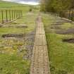
View of deck, top of the girders and handrails from S |
23/4/2009 |
Item Level |
|
 |
On-line Digital Images |
DP 323342 |
Records of CFA Archaeology Ltd, archaeologists, Musselburgh, East Lothian, Scotland |
Zipped folder containing field survey photographs taken by team A, Borders Railway Project |
1/3/2009 |
Item Level |
|


