 |
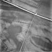
On-line Digital Images |
SC 1706430 |
RCAHMS Aerial Photography |
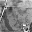
Oblique aerial view. |
1982 |
Item Level |
|
 |
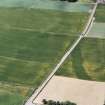
On-line Digital Images |
SC 1706652 |
RCAHMS Aerial Photography |
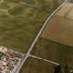
Oblique aerial view. |
1989 |
Item Level |
|
 |
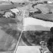
On-line Digital Images |
SC 1706653 |
RCAHMS Aerial Photography |
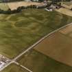
Oblique aerial view. |
1989 |
Item Level |
|
 |
On-line Digital Images |
SC 1706654 |
RCAHMS Aerial Photography |
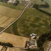
Oblique aerial view. |
1989 |
Item Level |
|
 |
On-line Digital Images |
SC 1706663 |
RCAHMS Aerial Photography |
Oblique aerial view. |
1989 |
Item Level |
|
 |
On-line Digital Images |
SC 1706703 |
RCAHMS Aerial Photography |
Oblique aerial view centred on linear cropmarks with further linear cropmarks, pit-alignment and Roman Road adjacent, taken from the ENE. |
6/7/1998 |
Item Level |
|
 |
On-line Digital Images |
SC 1782721 |
RCAHMS Aerial Photography |
Oblique aerial view. |
1992 |
Item Level |
|
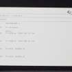 |
On-line Digital Images |
SC 2394836 |
Records of the Ordnance Survey, Southampton, Hampshire, England |
Huntingtower, NO02SE 67, Ordnance Survey index card, page number 1, Recto |
c. 1958 |
Item Level |
|
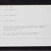 |
On-line Digital Images |
SC 2394837 |
Records of the Ordnance Survey, Southampton, Hampshire, England |
Huntingtower, NO02SE 67, Ordnance Survey index card, page number 2, Recto |
c. 1958 |
Item Level |
|


