 |
On-line Digital Images |
SC 1700143 |
RCAHMS Aerial Photography |
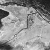
Allt a' Chaorainn, oblique aerial view, taken from the NW, centred on the remains of a township. |
13/5/1996 |
Item Level |
|
 |
On-line Digital Images |
SC 1768471 |
Records of the Royal Commission on the Ancient and Historical Monuments of Scotland (RCAHMS), Edinbu |
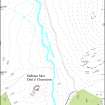
Plan of the archaeological landscape along the Allt a Chaorainn, Glen Banchor |
c. 11/1996 |
Item Level |
|
 |
On-line Digital Images |
SC 2388154 |
Records of the Ordnance Survey, Southampton, Hampshire, England |
Allt A' Chaorainn, NN69NE 11, Ordnance Survey index card, Recto |
c. 1958 |
Item Level |
|
 |
On-line Digital Images |
SC 2388155 |
Records of the Ordnance Survey, Southampton, Hampshire, England |
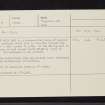
Allt A' Chaorainn, NN69NE 11, Ordnance Survey index card, Recto |
c. 1958 |
Item Level |
|


