 |
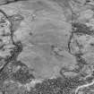
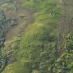
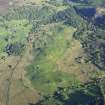
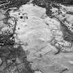
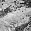
On-line Digital Images |
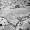
SC 503654 |
Records of the Royal Commission on the Ancient and Historical Monuments of Scotland (RCAHMS), Edinbu |
Little Rogart, oblique aerial view, taken from the SE, showing an area defined as an archaeological landscape. |
|
Item Level |
|
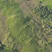 |
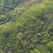
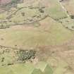
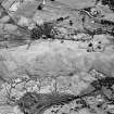
On-line Digital Images |
DP 080245 |
RCAHMS Aerial Photography Digital |
Oblique aerial view of Little Rogart, taken from the SSW. |
29/5/2009 |
Item Level |
|
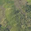 |
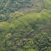
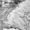
On-line Digital Images |
DP 080246 |
RCAHMS Aerial Photography Digital |
Oblique aerial view of Little Rogart, taken from the S. |
29/5/2009 |
Item Level |
|
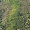 |
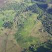
On-line Digital Images |
DP 080247 |
RCAHMS Aerial Photography Digital |
Oblique aerial view of Little Rogart, taken from the S. |
29/5/2009 |
Item Level |
|
 |
On-line Digital Images |
DP 080248 |
RCAHMS Aerial Photography Digital |
Oblique aerial view of Little Rogart, taken from the S. |
29/5/2009 |
Item Level |
|
 |
On-line Digital Images |
DP 080249 |
RCAHMS Aerial Photography Digital |
Oblique aerial view of Little Rogart, taken from the SSE. |
29/5/2009 |
Item Level |
|
 |
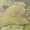
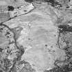
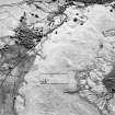
On-line Digital Images |
DP 080250 |
RCAHMS Aerial Photography Digital |
Oblique aerial view of the remains of the township of Little Rogart, Strathfleet, taken from the SE |
29/5/2009 |
Item Level |
|
 |
On-line Digital Images |
DP 080290 |
RCAHMS Aerial Photography Digital |
General oblique aerial view of Little Rogart, taken from the NNW. |
29/5/2009 |
Item Level |
|
 |
On-line Digital Images |
DP 080291 |
RCAHMS Aerial Photography Digital |
General oblique aerial view of Little Rogart, taken from the NNW. |
29/5/2009 |
Item Level |
|
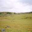 |
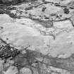
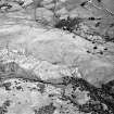
On-line Digital Images |
SC 1503201 |
Records of the Royal Commission on the Ancient and Historical Monuments of Scotland (RCAHMS), Edinbu |
General view of Little Rogart |
1995 |
Item Level |
|
 |
On-line Digital Images |
SC 1692916 |
RCAHMS Aerial Photography |
Little Rogart, oblique aerial view, taken from the E, showing an area defined as an archaeological landscape. |
23/6/1995 |
Item Level |
|
 |
On-line Digital Images |
SC 1692917 |
RCAHMS Aerial Photography |
Little Rogart, oblique aerial view, taken from the NNW, showing an area defined as an archaeological landscape. |
23/6/1995 |
Item Level |
|
 |
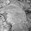
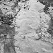
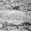
On-line Digital Images |
SC 1692940 |
RCAHMS Aerial Photography |
Little Rogart, oblique aerial view, taken from the NW, centred on an area defined as an archaeological landscape. Saint Callan's Church is visible in the upper half of the photograph, and the remains of a structure is shown in the upper left-hand corner. |
13/6/1995 |
Item Level |
|
 |
On-line Digital Images |
SC 1692962 |
RCAHMS Aerial Photography |
Little Rogart, oblique aerial view, taken from the S, showing an area defined as an archaeological landscape. |
23/6/1995 |
Item Level |
|
 |
On-line Digital Images |
SC 1692963 |
RCAHMS Aerial Photography |
Little Rogart, oblique aerial view, taken from the S, showing an area defined as an archaeological landscape. |
23/6/1995 |
Item Level |
|
 |
On-line Digital Images |
SC 1692964 |
RCAHMS Aerial Photography |
Little Rogart, oblique aerial view, taken from the NE, showing an area defined as an archaeological landscape. |
23/6/1995 |
Item Level |
|
 |
On-line Digital Images |
SC 1692965 |
RCAHMS Aerial Photography |
Little Rogart, oblique aerial view, taken from the N, showing an area defined as an archaeological landscape. |
23/6/1995 |
Item Level |
|
 |
On-line Digital Images |
SC 1692966 |
RCAHMS Aerial Photography |
Little Rogart, oblique aerial view, taken from the NW, showing an area defined as an archaeological landscape. |
23/6/1995 |
Item Level |
|
 |
On-line Digital Images |
SC 1692967 |
RCAHMS Aerial Photography |
Little Rogart, oblique aerial view, taken from the NW, showing an area defined as an archaeological landscape. |
23/6/1995 |
Item Level |
|
 |
On-line Digital Images |
SC 1692968 |
RCAHMS Aerial Photography |
Little Rogart, oblique aerial view, taken from the NW, showing an area defined as an archaeological landscape. |
23/6/1995 |
Item Level |
|
 |
On-line Digital Images |
SC 1692969 |
RCAHMS Aerial Photography |
Little Rogart, oblique aerial view, taken from the NW, showing an area defined as an archaeological landscape. |
23/6/1995 |
Item Level |
|
 |
On-line Digital Images |
SC 1692970 |
RCAHMS Aerial Photography |
Little Rogart, oblique aerial view, taken from the WNW, showing an area defined as an archaeological landscape. |
23/6/1995 |
Item Level |
|
 |
On-line Digital Images |
SC 1692971 |
RCAHMS Aerial Photography |
Little Rogart, oblique aerial view, taken from the WSW, showing an area defined as an archaeological landscape. |
23/6/1995 |
Item Level |
|
 |
On-line Digital Images |
SC 1692972 |
RCAHMS Aerial Photography |
Little Rogart, oblique aerial view, taken from the SW, showing an area defined as an archaeological landscape. |
23/6/1995 |
Item Level |
|


