Accessibility

Font Size

100% 150% 200%

Background Colour

Default Contrast
Close Reset

Rubha Lag Na Saille

Your Selection

Filter

No Available Filters

Save Search

Log in to save your search
Preview Category Catalogue Number Collection Title Date Level
Oblique aerial view of Lag na Saille, centred on the remains of the bothy, looking NW. On-line Digital Images DP 139350 RCAHMS Aerial Photography Digital Oblique aerial view of Lag na Saille, centred on the remains of the bothy, looking NW. 19/7/2012 Item Level
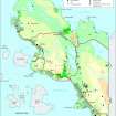
Map of the archaeology in the RCAHMS Achiltibuie survey area, 1994. Created for the RCAHMS broadsheet Achiltibuie - The Archaeology of a crofting landscape (WP003842.pdf)
On-line Digital Images SC 2035274 Records of the Royal Commission on the Ancient and Historical Monuments of Scotland (RCAHMS), Edinbu Map of the archaeology in the RCAHMS Achiltibuie survey area, 1994. Created for the RCAHMS broadsheet Achiltibuie - The Archaeology of a crofting landscape (WP003842.pdf) 1997 Item Level