
Bute, St Blane's, Macewen Enclosure


Burial Enclosure (20th Century)
Site Name Bute, St Blane's, Macewen Enclosure
Classification Burial Enclosure (20th Century)
Canmore ID 303298
Site Number NS05SE 5.26
NGR NS 09510 53421
Datum OSGB36 - NGR
Permalink http://canmore.org.uk/site/303298


- Council Argyll And Bute
- Parish Kingarth
- Former Region Strathclyde
- Former District Argyll And Bute
- Former County Buteshire
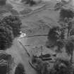
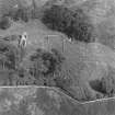
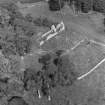
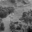
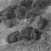
Aerial Photography (1970)
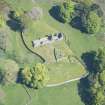
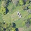
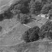
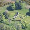
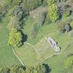
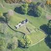
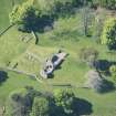
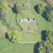
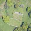
Oblique aerial photographs of the remains of St Blane's Church and burial ground, Bute, taken by John Dewar in 1970.
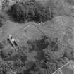
Field Visit (31 March 2010)
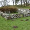
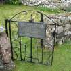
This square burial enclosure is situated in the lower graveyard at St Blane's and was not recorded in detail on the date of visit. The gate incorporates a memorial plaque to the MacEwan family of Garrochty Farm and the only gravestone within the interior is dated 1958.
Visited by RCAHMS (GFG) 31 March 2010.

