
Suttie


Enclosure (Period Unassigned), Palisaded Enclosure (Period Unassigned)(Possible), Pit(S) (Period Unassigned), Rig And Furrow (Medieval) - (Post Medieval), Ring Ditch(S) (Period Unassigned)
Site Name Suttie
Classification Enclosure (Period Unassigned), Palisaded Enclosure (Period Unassigned)(Possible), Pit(S) (Period Unassigned), Rig And Furrow (Medieval) - (Post Medieval), Ring Ditch(S) (Period Unassigned)
Alternative Name(s) Wester Fintray
Canmore ID 83672
Site Number NJ81NW 38
NGR NJ 81180 15810
NGR Description Centred NJ 81180 15810
Datum OSGB36 - NGR
Permalink http://canmore.org.uk/site/83672


- Council Aberdeenshire
- Parish Fintray
- Former Region Grampian
- Former District Gordon
- Former County Aberdeenshire
NJ81NW 38.00 Centred NJ 81182 15819
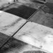
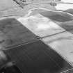
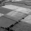
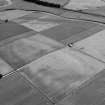
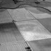
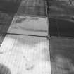
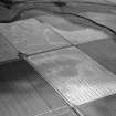
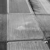
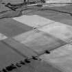
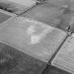
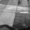
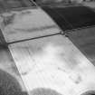
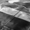
NJ81NW 38.01 NJ 8118 1581 Ring-ditch; Enclosure; Rig (GRC 32)
NJ81NW 38.02 NJ 8133 1580 Enclosure: Palisaded (possible) (GRC 36)
NJ81NW 38.03 NJ 8131 1572 Ring-ditch (GRC 37)
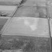
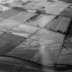
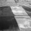
(Location cited as NJ 8133 1580 and name as Wester Fintray). Air photography (BKS vertical NJ81N 2729148, flown 1977, and GRC/AAS 1983, 1984 and 1986) has recorded cropmarks at an altitude of 50m OD. They include those of a palisaded enclosure, and may represent a homestead.
[Air photographic imagery listed].
NMRS, MS/712/36.

