Following the launch of trove.scot in February 2025 we are now planning the retiral of some of our webservices. Canmore will be switched off on 24th June 2025. Information about the closure can be found on the HES website: Retiral of HES web services | Historic Environment Scotland
Inch Kenneth, Saint Kenneth's Chapel
Burial Ground (Period Unassigned), Church (13th Century), Cross (Period Unassigned), Grave Slab(S) (Period Unassigned)
Site Name Inch Kenneth, Saint Kenneth's Chapel
Classification Burial Ground (Period Unassigned), Church (13th Century), Cross (Period Unassigned), Grave Slab(S) (Period Unassigned)
Alternative Name(s) St Cainneach's Chapel; Inchkenneth Chapel
Canmore ID 22010
Site Number NM43NW 1
NGR NM 43748 35435
Datum OSGB36 - NGR
Permalink http://canmore.org.uk/site/22010
- Council Argyll And Bute
- Parish Kilfinichen And Kilvickeon
- Former Region Strathclyde
- Former District Argyll And Bute
- Former County Argyll
NM43NW 1 43748 35435
(NM 4374 3542) Chapel (NR) (rems of)
Burial Ground (NAT)
OS 1:10,000 map (1976)
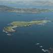
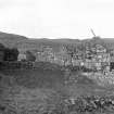
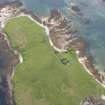
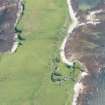
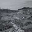
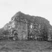
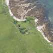
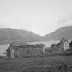
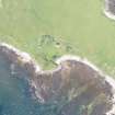
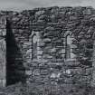
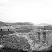
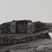
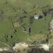
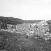
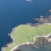
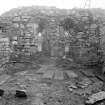
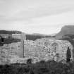
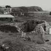
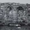
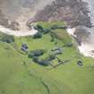
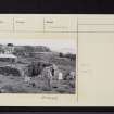
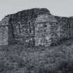
Chapel, Inch Kenneth: The ruins of this 13th century parish church stand on gently sloping ground above a sandy beach which forms a convenient landing-place for small boats. The site is sheltered by slightly higher ground to the W, and part of this area has been cut off by a curving wall, now represented by a stony mound of turf, to form the main portion of the present burial-ground. A post-Reformation burial-enclosure is built against the E end of the S wall of the church, while the foundations of two similar enclosures are traceable about 10m E of the church, and 25m to the S.
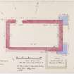
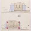
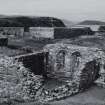
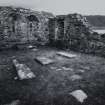
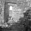
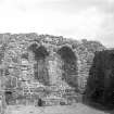
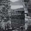
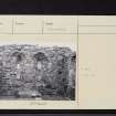
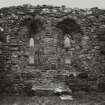
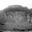
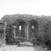
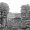
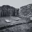
The church is a unicameral structure measuring 12.3m from E to W by 6m transversely within walls varying in thickness from 0.9m to 1.2m. It stands complete to wall-head level, except for the W portion of the S wall, which is reduced to a height of about 1.4m; the gables of the end-walls, which are now reduced to about the same height as the side-walls, appear to have been intact in 1815. At some period probably in the 16th or 17th century, the E gable-wall developed a dangerous outward tilt which was arrested by the construction of two massive clasping buttresses. Within the building, the division between nave and chancel is marked by a step down into the latter, which retains some paving-slabs. The base of an altar stands against the centre of the E wall.
Although the church and island derive their name from St Cainnech of Aghaboe, a contemporary of St Columba, there is no physical evidence for the Early Christian 'college' whose traditional existence inspired Dr Johnson in 1773 to compose a Latin ode. The building described above, which may be attributed to the 13th century on the evidence of its plan-form and window details, is identified by Fordun, writing about 1380, and Monro in 1549, as a parish church. By the 16th century, and probably considerably earlier, the parsonage was appropriated to the Augustinian nunnery of Iona. The church probably ceased to be used as a place of worship after the alienation of the lands of Iona Nunnery by the last prioress to Hector MacLean of Duart in 1547. It was utilized in the following centuries for many burials.
The building and early stones were taken into guardianship by the then Office of Works in 1926, and essential clearance and consolidation were subsequently undertaken.
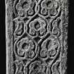
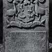
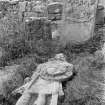
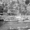
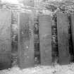
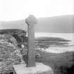
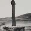
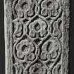
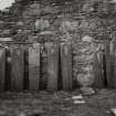
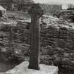
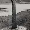
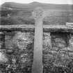
Within the church are eight West Highland grave-slabs dating between the 14th and early 16th centuries, and standing outside the SW corner of the church is a ring-headed cross of slate, erected on its present site in 1926. It probably dates from the period 1500-1560. There are also a number of 17th and 18th century table-tombs and headstones in the burial-ground.
RCAHMS 1980, visited 1973.
The chapel is as described. The burial-ground is still in use.
Surveyed at 1:10,000.
Visited by OS (DWR) 30 May 1972.
Site recorded from draft text of Discovery and Excavation in Scotland 1998 (ref 98/308), held by Council for Scottish Archaeology.
CSA 1998
Awaiting DES entry 98/308.
Antiquarian Observation (1877)
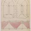
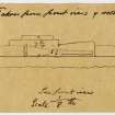
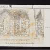
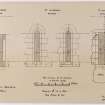
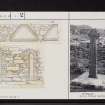
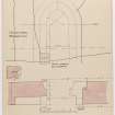
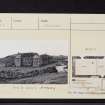
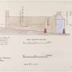
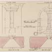
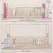
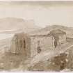
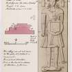
Drawings of Saint Kenneth's chapel, Inch Kenneth, Mull by Sir Henry Dryden 1877 with notes.
Publication Account (1985)
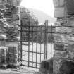
Although now roofless, the chapel on Inchkenneth offers the visitor a good impression of the scale of the parish church of the mid-13th century; the dedication to St Cainnech of Aghaboe, a contemporary ofSt Columba, however, implies an earlier foundation of which there is now no trace. The chancel and nave form a single unit, with the floor of the chancel set a little lower than that of the nave. There was little embellishment either round the doorway on the north side or the windows, one each on the north and south wall of the chancel, and a pair of lancet windows on the east. Twin-light east windows are a characteristic feature of the comparatively simple churches of this period in the west. Dr Johnson, who visited Inchkenneth in 1772, noted 'On one side of the altar is a bas relief of the blessed Virgin, and by it lies a little bell; which, though cracked, and without a dapper, has remained there for ages, guarded only by the venerableness of the place. The ground round the chapel is covered with grave-stones of Chiefs and ladies ...'
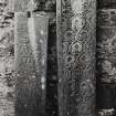
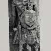
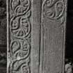
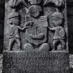
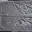
The graveslabs form an important collection and several are now protected within the chapel; two are illustrated here: one with a sword above a galley without a sail, with plant-scroll decoration on either side of the sword; the second has heavier more formalised plant decoration with paired animal ornament near the head and a hound and stag at the foot. The second stone is a good example of the Iona School of carving of about the 14th to 15th century AD.
Information from ‘Exploring Scotland’s Heritage: Argyll and the Western Isles’, (1985).
Watching Brief (14 May 2012 - 16 May 2012)
NM 4373 3544 A watching brief was carried out 14–16 May 2012 during the excavation of five trenches associated with construction to provide access to the 13th-century chapel and burial ground. There were no finds or features of archaeological significance.
Archive: RCAHMS (intended)
Funder: Historic Scotland
Paul Fox, Kirkdale Archaeology
2012


