Scheduled Maintenance
Please be advised that this website will undergo scheduled maintenance on the following dates: •
Tuesday 3rd December 11:00-15:00
During these times, some services may be temporarily unavailable. We apologise for any inconvenience this may cause.
Wauchope Castle
Castle (Medieval), Kiln(S) (Post Medieval), Manse (Post Medieval) - (18th Century), Motte And Bailey (Medieval), Hasp (13th Century), Unidentified Pottery (Medieval)
Site Name Wauchope Castle
Classification Castle (Medieval), Kiln(S) (Post Medieval), Manse (Post Medieval) - (18th Century), Motte And Bailey (Medieval), Hasp (13th Century), Unidentified Pottery (Medieval)
Alternative Name(s) Springfield; Langholm Manse; Springhill; Wauchope Water; Becks Burn; Back Burn; Wauchope, Castle Earthworks
Canmore ID 67651
Site Number NY38SE 1
NGR NY 35474 83989
Datum OSGB36 - NGR
Permalink http://canmore.org.uk/site/67651
- Council Dumfries And Galloway
- Parish Langholm
- Former Region Dumfries And Galloway
- Former District Annandale And Eskdale
- Former County Dumfries-shire
NY38SE 1 35474 83989
(NY 3545 8397) Wauchope Castle (NR) (Site of)
OS 6" map (1957)
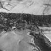
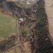
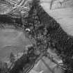
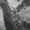
Wauchope Castle was built on the site of a motte and bailey, on the N side of a deep gorge through which runs the Wauchope Water. The motte had been levelled (either by nature or by man) before the stone castle was erected. The lands of Wauchope were granted to the Lindsays in 1285, and the castle was probably built soon after that date. It had fallen into ruins by 1580, and the post-Reformation manse of the parish was built on the ruins and remained in use until the mid- 18th century.
A preliminary excavation was carried out in 1966 in an attempt to establish the form and extent of the castle, of which nothing is visible on the ground. J and R Hyslop (1912) mention an excavation towards the end of the 19th century but gives no details of any discoveries then made. Most of the remains uncovered in 1966 were of, or associated with, the manse. However, the foundation of the castle wall, 4ft thick, and built of stones taken from the river, was found under the manse walls. Most of the stones were unworked and bound with shell mortar. Among the artifacts found were a chisel-like implement and a sherd of pottery, the latter datable to 1250-1300.
All finds are in Dumfries Museum, while in the NMAS is a 13th century school of Limoges enamelled copper hasp of a coffer, found here in 1895.
Glasgow Art Gallery and Museum 1951; A E Truckell and J Williams 1967; A McCracken 1970.
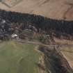
The castle site stands on a long, narrow, 4.0m high plateau which is bounded on the E by the Wauchope Water and elsewhere by a ditch and bank. The level top is featureless except for the rectangular, turf-covered foundations of the manse and an amorphous pit at the S end; it is approached from the W by a narrow track. The ditch, which is utilised by a road on the W side, averages 1.5m deep and the bank is up to 1.7m high. Its course is lost on the NW corner; however, there is a section of rock-cut ditch which links into Becks Burn (a tributary of the Wauchope Water) on the N side.
Surveyed at 1/2500.
Visited by OS (MJF) 27 September 1979
Scheduled as Wauchope Castle, castle and manse 235m SSW of Springhill... the remains of a medieval motte-and bailey castle, a later stone castle and a 17th-century manse'.
[The scheduling map depicts depicts the area of the monument as extending to the W of the public road].
Information from Historic Scotland, scheduling document dated 15 March 2010.
Castle Earthworks [NAT]
OS (GIS) MasterMap, April 2010.
Field Visit (March 1981)
Wauchope Castle NY 354 839 NY38SE 1
The site of Wauchope Castle lies on a low eminence flanked on the SE by the Wauchope Water and elsewhere by a flat-bottomed ditch (7m broad) with an external bank (up to 5m thick and 0.9m high), although on the NE these have been almost entirely removed. The only visible remains on the level summit of the eminence (90m from NE to SW by 28m transversely) are the footings of the former manse (abandoned in the mid 18th century), beneath which excavation in 1966 located the foundation of the castle wall. Finds from the excavation include a sherd of 13th-century pottery.
RCAHMS 1981, visited March 1981
(Hyslop and Hyslop 1912, 322-8; Truckell and Williams 1967, 167; McCracken 1970)
Measured Survey (1 August 1991)
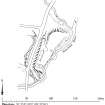
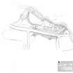
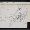
RCAHMS surveyed the motte at Wauchope Castle on 1 August 1991 with plane-table and self-reducing alidade at a scale of 1:500. The plan was redrawn in ink and published at a scale of 1:2500 (RCAHMS 1997, Fig. 202).
Field Visit (1 August 1991)
NY 3545 8397 NY38SE 1
The site of Wauchope Castle lies upon a low eminence which is flanked on the E by the steep cliffs of the Wauchope Water, on the N by the Back [Becks] Burn, and on the W and S by a ditch (7m broad) and an external bank (up to 5m thick and 0.9m high). The B 7068 public road now runs through this ditch and two kilns have been set into the bank. A trackway which is probably of relatively recent date has been constructed across the N face of the eminence.
The level summit measures 90m from NE to SW by 28m transversely and the most prominent feature upon it is the former manse of Wauchope which was abandoned in the mid 18th century. This now appears as the stone wall-footings of a two-compartment building measuring 21m by 6.2m overall. At right-angles to it on the S, but largely removed by quarrying, there are the remains of a second building. A third building (measuring 6.5m by 4m over turf-covered stone wall-footings, lies on the S, a little above the bottom of the ditch.
Visited by RCAHMS (PC) 1 August 1991.
Note (11 July 1995)
NY 3545 8397 NY38SE 1
The Dumfries Museum accession number for medieval pottery from this site is DUMFM: 1966.152.
Information from RCAHMS (JRS) 11 July 1995.


