
South Woodfoot


Enclosure (Period Unknown)(Possible)
Site Name South Woodfoot
Classification Enclosure (Period Unknown)(Possible)
Canmore ID 75035
Site Number NY37SW 26
NGR NY 31181 72356
Datum OSGB36 - NGR
Permalink http://canmore.org.uk/site/75035


- Council Dumfries And Galloway
- Parish Half Morton
- Former Region Dumfries And Galloway
- Former District Annandale And Eskdale
- Former County Dumfries-shire
Aerial Photographic Transcription (16 February 1993 - 2 March 1993)
An aerial transcription was produced from oblique aerial photographs. Information from Historic Environment Scotland (BM) 31 March 2017.
Aerial Photographic Interpretation (20 February 1996)
NY37SW 26 3118 7236
See also NY37SW 15 and 16.
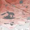
Air photography (RCAHMSAP 1984) has recorded what may be the NE side of a narrow-ditched enclosure 200m NE of South Woodfoot steading (NY37SW 50). The overall shape of the enclosure is uncertain.
Information from RCAHMS (SPH), 20 February 1996.
Listed as enclosure (possible).
RCAHMS 1997.
Aerial Photographic Transcription (5 November 2012)
An interpretative transcription, or mapping, of information on oblique aerial photographs was produced on 05 November 2012.

