
Milligansbush


Enclosure (Period Unknown)
Site Name Milligansbush
Classification Enclosure (Period Unknown)
Canmore ID 67557
Site Number NY37SW 14
NGR NY 31461 71252
Datum OSGB36 - NGR
Permalink http://canmore.org.uk/site/67557


- Council Dumfries And Galloway
- Parish Gretna
- Former Region Dumfries And Galloway
- Former District Annandale And Eskdale
- Former County Dumfries-shire
Aerial Photographic Transcription (16 February 1993 - 2 March 1993)
An aerial transcription was produced from oblique aerial photographs. Information from Historic Environment Scotland (BM) 31 March 2017.
Aerial Photographic Interpretation (20 February 1996)
NY37SW 14 3145 7125
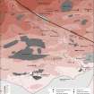
Air photography (RCAHMSAP 1984) has recorded the cropmarks of part of a rectilinear enclosure on the E side of the public road immediately N of Milligansbush steading (NY37SW 44). It measures 106m from N to S by at least 80m transversely within a ditch 2m in breadth; there is a possible entrance midway along the E side.
Information from RCAHMS (SPH), 20 February 1996.
Listed as (rectilinear) enclosure.
RCAHMS 1997.
Aerial Photographic Transcription (5 November 2012)
An interpretative transcription, or mapping, of information on oblique aerial photographs was produced on 05 November 2012.

