
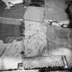
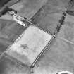
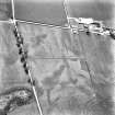
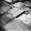
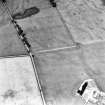
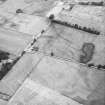
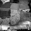
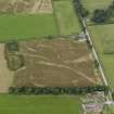
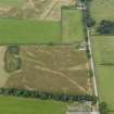
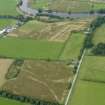
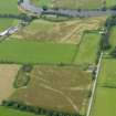
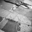
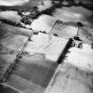
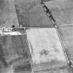
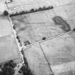
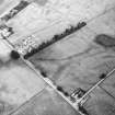
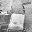
Glenlochar


Fort Annexe (Roman)
Site Name Glenlochar
Classification Fort Annexe (Roman)
Alternative Name(s) Montford
Canmore ID 64695
Site Number NX76SW 4
NGR NX 73930 64452
Datum OSGB36 - NGR
Permalink http://canmore.org.uk/site/64695


- Council Dumfries And Galloway
- Parish Crossmichael
- Former Region Dumfries And Galloway
- Former District Stewartry
- Former County Kirkcudbrightshire
NX76SW 4 73930 64452
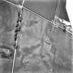
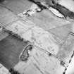
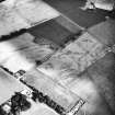
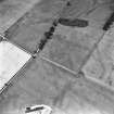
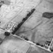
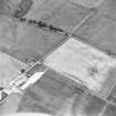
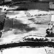
(NX 7390 6440) Roman Marching Camp (R)
(Site of)
OS 6" map (1957).
See also NX76SW 5.
This camp is part of a complex of forts and camps at Glenlochar, ? Agricolan to Antonine.
(Information from J K St Joseph 1949).
J K St Joseph 1951; J K St Joseph 1958.
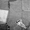
No trace visible on ground. Almost certainly an annexe to the adjoining camp (NX76SW 5).
Surveyed from St Joseph AP and ground observation.
Visited by OS (RD), 13 August 1968.
Annexe
(site of) [NAT] (at NX 7351 6468)
OS (GIS) MasterMap, March 2011.
Scheduled (with NX76SW 2-3, 5-6, 23, 24 and 29) as 'Glenlochar, Roman fort, annexe, road, camps and barrows 50m E of Montford....'.
Information from Historic Scotland, scheduling document dated 1 March 2011.

